Cof Cymru: National Historic Assets of Wales · Wales
Village Hall
Nevern, Pembrokeshire, Wales
A Grade II listed building in Nevern, Pembrokeshire, designated on 27 October 1992.
The record
- Designation
- Listed building, Grade II
- Broad class
- Domestic
- Date of designation
- 27 October 1992
- Community
- Nevern
- Unitary authority
- Pembrokeshire
- Country
- Wales
- Coordinates
- 52.02423, -4.79519
- Cadw reference
- 12751
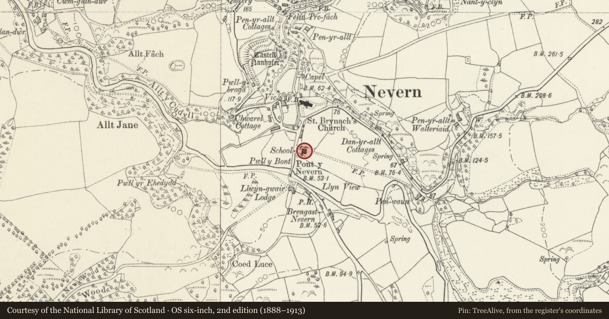
Slide toward Today to fade the historical sheet and see the modern map underneath.
David Rumsey Map Collection, Stanford LibrariesDavid Rumsey Map Collection, Stanford LibrariesDavid Rumsey Map Collection, Stanford LibrariesDavid Rumsey Map Collection, Stanford LibrariesDavid Rumsey Map Collection, Stanford Libraries
5 historical maps cover this location, the earliest the 1608 map "(13) Cambriae Typus." (David Rumsey Map Collection, Stanford Libraries).
Historical maps covering this location
- 1608 · (13) Cambriae Typus. (David Rumsey Map Collection, Stanford Libraries)
- 1891 · Sheet 10. Ordnance Survey of England and Wales. . (David Rumsey Map Collection, Stanford Libraries)
- 1898 · 210 Cardigan (Hills) (David Rumsey Map Collection, Stanford Libraries)
- 1898 · 210 Cardigan (Outline) (David Rumsey Map Collection, Stanford Libraries)
- 1901 · Sheet 13. (David Rumsey Map Collection, Stanford Libraries)
Cadw's description
Location
Set back from road some 100 m NE of Nevern Bridge.
History
Llwyngwair MSS record the lease by J.B.Bowen of Nevern Chapel to the school board 1872 and 1877 and a contract to enlarge schoolroom 1894.
Exterior
Early C19 nonconformist chapel, converted and extended as school in later C19, now village hall. The original chapel is in squared blue lias stone with hipped slate roof. One big pointed window each end and two to N wall, all with cut stone voussoirs, slate sills and intersecting glazing bars. South side has later C19 added wing, gabled to S, coped with lean-to each side. Gable has large pointed window with timber mullions, lean-tos have end lancets, one altered, and doors in side walls. Added brick lean-to on E side.
Nearby in the register
- Telephone Call-box outside TyrllanCommunicationsunder 1 mi
- Nevern BridgeTransportunder 1 mi
- Mounting Block by Churchyard entry to Church of St BrynarchReligious, Ritual and Funeraryunder 1 mi
- Gate to New Chruchyard at Church of St BrynarchReligious, Ritual and Funeraryunder 1 mi
Other entries of the same register within about three miles of this one, by straight line.