Cof Cymru: National Historic Assets of Wales · Wales
L-Plan range of outbuildings to NE. of Llwyngoras
Nevern, Pembrokeshire, Wales
A Grade II listed building in Llwyngoras, Nevern, Pembrokeshire, designated on 27 October 1992.
The record
- Designation
- Listed building, Grade II
- Broad class
- Domestic
- Date of designation
- 27 October 1992
- Locality
- Llwyngoras
- Community
- Nevern
- Unitary authority
- Pembrokeshire
- Country
- Wales
- Coordinates
- 52.02139, -4.78121
- Cadw reference
- 12775
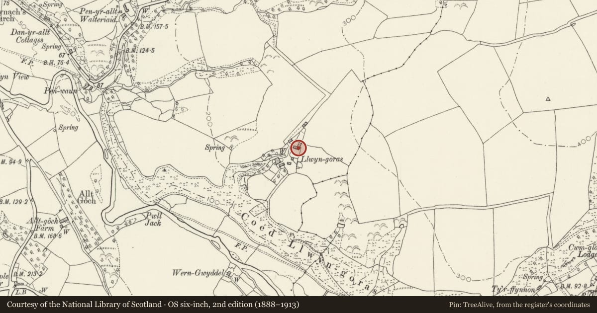
Slide toward Today to fade the historical sheet and see the modern map underneath.
David Rumsey Map Collection, Stanford LibrariesDavid Rumsey Map Collection, Stanford LibrariesDavid Rumsey Map Collection, Stanford LibrariesDavid Rumsey Map Collection, Stanford LibrariesDavid Rumsey Map Collection, Stanford Libraries
5 historical maps cover this location, the earliest the 1636 map "Cornubia : Devonia, Somersetus, Dorcestria, Wiltonia, Glocestria ..." (David Rumsey Map Collection, Stanford Libraries).
Historical maps covering this location
- 1636 · Cornubia : Devonia, Somersetus, Dorcestria, Wiltonia, Glocestria ... (David Rumsey Map Collection, Stanford Libraries)
- 1891 · Sheet 10. Ordnance Survey of England and Wales. . (David Rumsey Map Collection, Stanford Libraries)
- 1898 · 210 Cardigan (Hills) (David Rumsey Map Collection, Stanford Libraries)
- 1898 · 210 Cardigan (Outline) (David Rumsey Map Collection, Stanford Libraries)
- 1901 · Sheet 13. (David Rumsey Map Collection, Stanford Libraries)
Cadw's description
Location
Situated enclosing two sides of yard open to NW, some 100m NE of house.
Exterior
Early and later C19 range of outbuildings in rubble stone with corrugated asbestos roofs, single storey with taller lofted SW end section.
SW end has gable with heavy cornerstones, first floor door and 3 tiers of dove holes in gable. S side centre door with brick head adjoining outside stairs to off-centre loft door above. Stonework is banded to right of loft door. To E is 6-bay lower range with slate roof, S side broad timber-lintel entry and one door to N, near angle to range running N.
Range running N is slightly lower with concrete lean-to in angle, then door with timber lintel, vent-loop and small window towards N end. Added slate-roofed section to N with three doors, part roofless.
Grassed ramp in courtyard in front of both ranges.
Part of this group is probably the L-plan range shown on 1843 Tithe Map.
Reason for designation
Group value with house and other outbuildings.
Nearby in the register
- Coach House at LlwyngorasDomesticunder 1 mi
- Outbuilding to SE of LlwyngorasDomesticunder 1 mi
- Llwyngoras, including Garden Walls with Gate PiersDomesticunder 1 mi
- Wern GwyddelDomesticunder 1 mi
Other entries of the same register within about three miles of this one, by straight line.