Cof Cymru: National Historic Assets of Wales · Wales
Gate to New Chruchyard at Church of St Brynarch
Nevern, Pembrokeshire, Wales
A Grade II listed building in Nevern, Pembrokeshire, designated on 27 October 1992.
The record
- Designation
- Listed building, Grade II
- Broad class
- Religious, Ritual and Funerary
- Date of designation
- 27 October 1992
- Community
- Nevern
- Unitary authority
- Pembrokeshire
- Country
- Wales
- Coordinates
- 52.02505, -4.79507
- Cadw reference
- 12749
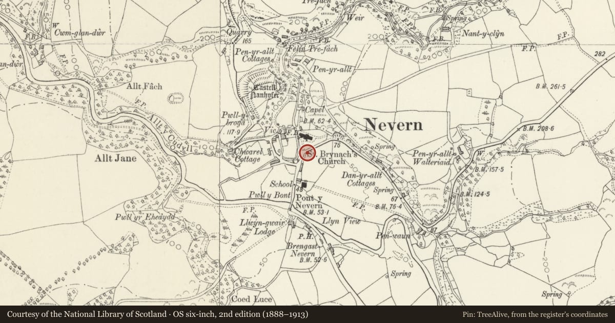
Slide toward Today to fade the historical sheet and see the modern map underneath.
David Rumsey Map Collection, Stanford LibrariesDavid Rumsey Map Collection, Stanford LibrariesDavid Rumsey Map Collection, Stanford LibrariesDavid Rumsey Map Collection, Stanford LibrariesDavid Rumsey Map Collection, Stanford Libraries
5 historical maps cover this location, the earliest the 1608 map "(13) Cambriae Typus." (David Rumsey Map Collection, Stanford Libraries).
Historical maps covering this location
- 1608 · (13) Cambriae Typus. (David Rumsey Map Collection, Stanford Libraries)
- 1891 · Sheet 10. Ordnance Survey of England and Wales. . (David Rumsey Map Collection, Stanford Libraries)
- 1898 · 210 Cardigan (Hills) (David Rumsey Map Collection, Stanford Libraries)
- 1898 · 210 Cardigan (Outline) (David Rumsey Map Collection, Stanford Libraries)
- 1901 · Sheet 13. (David Rumsey Map Collection, Stanford Libraries)
Cadw's description
Location
Situated across road from entry to churchyard of church of Saint Brynach.
Exterior
1810 dated cast-iron gate reused between stone gatepiers of circa 1928. Piers have concrete stepped caps and ball finials, curving rubble walls each side. Gate has diagonally intersected bars to lowest section then rail of quatrefoils with spearheads between upper stanchions with spearheads over down-curved top. Plaque with G.B. of G.J.B. monogramme on front and 1810 on rear, presumably for George Bowen of Llwyngwair (d 1810).
Reason for designation
Included for cast-iron gate and group value with church and churchyard.
Nearby in the register
- Mounting Block by Churchyard entry to Church of St BrynarchReligious, Ritual and Funeraryunder 1 mi
- High Cross in ChurchyardCrossunder 1 mi
- Churchyard of Church of St Brynarch, including Wall & GatesReligious, Ritual and Funeraryunder 1 mi
- Inscribed Stone in ChurchyardInscribed Stoneunder 1 mi
Other entries of the same register within about three miles of this one, by straight line.