Cof Cymru: National Historic Assets of Wales · Wales
Churchyard of Church of St Brynarch, including Wall & Gates
Nevern, Pembrokeshire, Wales
A Grade II* listed building in Nevern, Pembrokeshire, designated on 16 January 1952.
The record
- Designation
- Listed building, Grade II*
- Broad class
- Religious, Ritual and Funerary
- Date of designation
- 16 January 1952
- Community
- Nevern
- Unitary authority
- Pembrokeshire
- Country
- Wales
- Coordinates
- 52.02537, -4.79508
- Cadw reference
- 12747
Slide toward Today to fade the historical sheet and see the modern map underneath.
David Rumsey Map Collection, Stanford LibrariesDavid Rumsey Map Collection, Stanford LibrariesDavid Rumsey Map Collection, Stanford LibrariesDavid Rumsey Map Collection, Stanford LibrariesDavid Rumsey Map Collection, Stanford Libraries
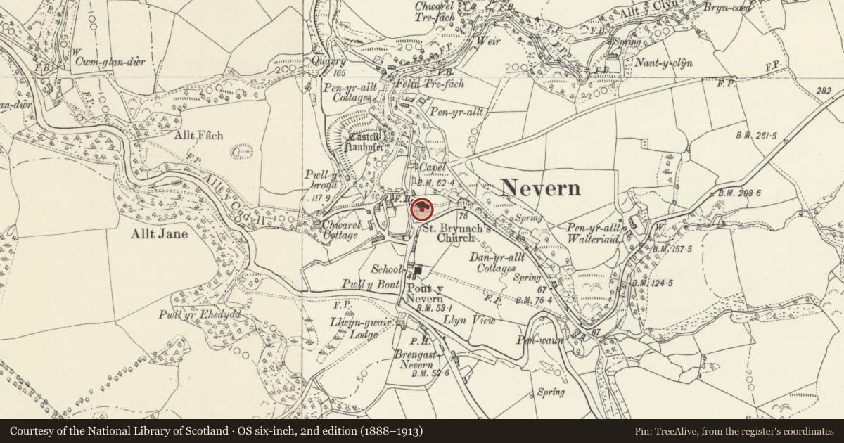
5 historical maps cover this location, the earliest the 1608 map "(13) Cambriae Typus." (David Rumsey Map Collection, Stanford Libraries).
Historical maps covering this location
- 1608 · (13) Cambriae Typus. (David Rumsey Map Collection, Stanford Libraries)
- 1891 · Sheet 10. Ordnance Survey of England and Wales. . (David Rumsey Map Collection, Stanford Libraries)
- 1898 · 210 Cardigan (Hills) (David Rumsey Map Collection, Stanford Libraries)
- 1898 · 210 Cardigan (Outline) (David Rumsey Map Collection, Stanford Libraries)
- 1901 · Sheet 13. (David Rumsey Map Collection, Stanford Libraries)
Cadw's description
Location
Parish churchyard around Church of St Brynach, steeply sloping to N of church and surrounded by rubble stone walls or embankments, and with principal gateway to S, smaller gates to NW and E.
Exterior
South gates have blue lias ashlar piers with cornices and balls and cast iron gate dated 1823. Iron overthrow. East end gate possibly not on original site as wider than present opening, similar to S gate, cast-iron. NW gateway has stone arch with voussoirs and keystone and iron gate with quatrefoil bottom and mid rails.
Within churchyard is fine avenue of yews leading to S porch and most notably the C10 to C11 Great Cross (Scheduled Ancient Monument Pe 164), one of the finest in Wales, and the Vitalianus Stone (Scheduled Ancient Monument Pe 151) possibly C5 with 'Vitaliani' in Latin and Ogham.
Numerous slate headstones and some table tombs of late C18 and C19 and the family vault of the Bowens of Llwyngwair, a rubble faced embankment with ashlar corner piers and slate plaques, the enclosure in front with low wall and ashlar piers. Inscriptions to Bowen family members and Griffiths family. At end cross of 1908 to "Tegid", Reverend John-Jones, vicar 1842-52, poet and scholar.
Reason for designation
Group value with Parish Church and Scheduled Ancient Monuments Pe 151 and 164.
Nearby in the register
- High Cross in ChurchyardCrossunder 1 mi
- Inscribed Stone in ChurchyardInscribed Stoneunder 1 mi
- Church of St BrynarchReligious, Ritual and Funeraryunder 1 mi
- Gate to New Chruchyard at Church of St BrynarchReligious, Ritual and Funeraryunder 1 mi
Other entries of the same register within about three miles of this one, by straight line.