Cof Cymru: National Historic Assets of Wales · Wales
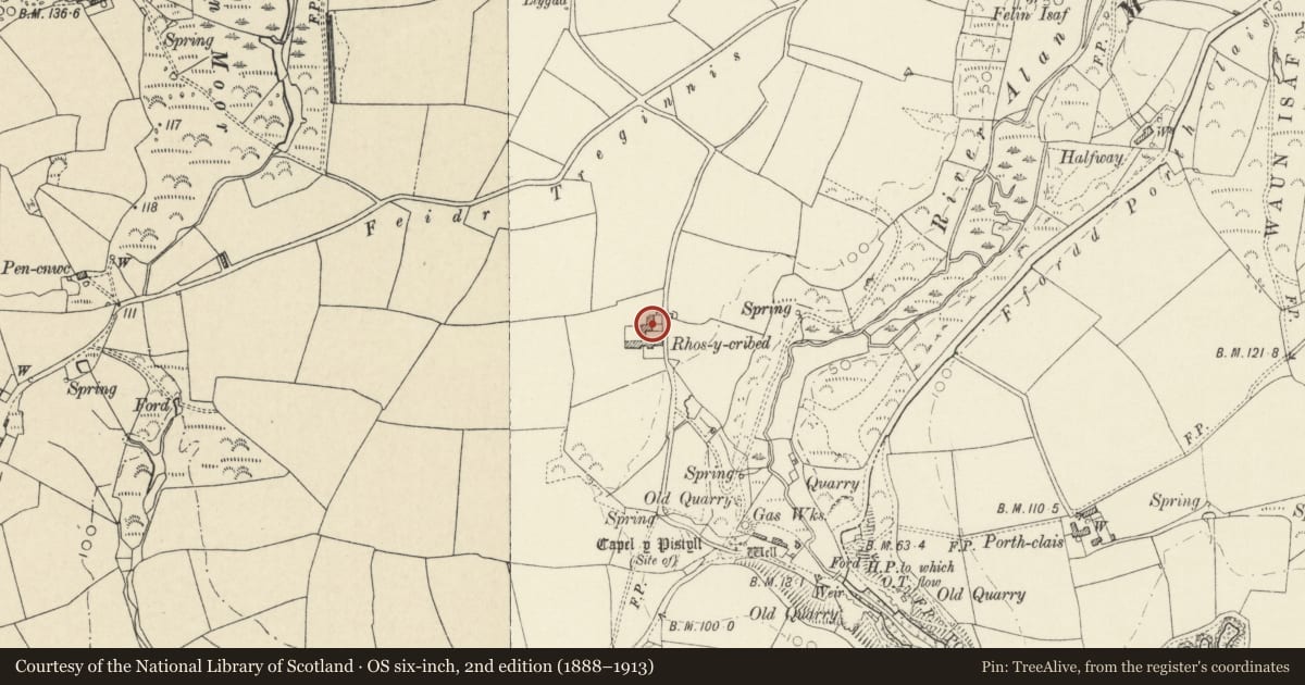
Rhos y Cribed & Outbuilding to NW
St. David's and the Cathedral Close, Pembrokeshire, Wales
A Grade II listed building in Porthclais, St. David's and the Cathedral Close, Pembrokeshire, designated on 28 July 1992.
The record
- Designation
- Listed building, Grade II
- Broad class
- Domestic
- Date of designation
- 28 July 1992
- Locality
- Porthclais
- Community
- St. David's and the Cathedral Close
- Unitary authority
- Pembrokeshire
- Country
- Wales
- Coordinates
- 51.87360, -5.28709
- Cadw reference
- 12689
Slide toward Today to fade the historical sheet and see the modern map underneath.
David Rumsey Map Collection, Stanford LibrariesDavid Rumsey Map Collection, Stanford LibrariesDavid Rumsey Map Collection, Stanford LibrariesDavid Rumsey Map Collection, Stanford LibrariesDavid Rumsey Map Collection, Stanford Libraries
5 historical maps cover this location, the earliest the 1608 map "(13) Cambriae Typus." (David Rumsey Map Collection, Stanford Libraries).
Historical maps covering this location
- 1608 · (13) Cambriae Typus. (David Rumsey Map Collection, Stanford Libraries)
- 1636 · Cornubia : Devonia, Somersetus, Dorcestria, Wiltonia, Glocestria ... (David Rumsey Map Collection, Stanford Libraries)
- 1637 · Particular description of Wales. Cambria seu Wallia (David Rumsey Map Collection, Stanford Libraries)
- 1898 · 209 St David's (Hills) (David Rumsey Map Collection, Stanford Libraries)
- 1901 · Sheet 13. (David Rumsey Map Collection, Stanford Libraries)
Cadw's description
Location
Situated on western side of lane running N from Porthclais, some 450m NW of bridge.
Exterior
Mid C19 farmhouse in rubble stone with red brick dressings and grouted slate roofs. Main range is of two storeys and attic with large stone end stacks and two large 12-pane sashes to each floor. Flush red brick window surrounds and slate sills. Slate-hung S end wall with 12-pane attic window. North end has attic window in brick surround and gabled porch projection with N end large round-arched window. Lower range attached to S with stone S end stack, double fronted with two 9-pane windows above and two 12-pane windows below, brick surrounds and slate sills. Centre door in C20 red brick flat-roofed porch. Front garden enclosed by rubble wall with C20 brick coping. Ashlar piers with moulded caps at right end, adjoining rubble outbuilding with hipped slate roof and E end cart-entry, which encloses N side of garden.
Reason for designation
Buildings to different plan on 1840 Tithe Map.
A good example of C19 farmhouse, little altered.
Nearby in the register
- Well, south of Rhos-y-CribedHoly Wellunder 1 mi
- Footbridge adjacent to Road BridgeTransportunder 1 mi
- One of a Pair of Limekilns on western side of slipwayIndustrialunder 1 mi
- One of a Pair of Limekilns on Western Side of SlipwayIndustrialunder 1 mi
Other entries of the same register within about three miles of this one, by straight line.