Cof Cymru: National Historic Assets of Wales · Wales
One of a Pair of Limekilns on western side of slipway
St. David's and the Cathedral Close, Pembrokeshire, Wales
A Grade II listed building in Porthclais, St. David's and the Cathedral Close, Pembrokeshire, designated on 28 July 1992.
The record
- Designation
- Listed building, Grade II
- Broad class
- Industrial
- Date of designation
- 28 July 1992
- Locality
- Porthclais
- Community
- St. David's and the Cathedral Close
- Unitary authority
- Pembrokeshire
- Country
- Wales
- Coordinates
- 51.87030, -5.28326
- Cadw reference
- 12687
Slide toward Today to fade the historical sheet and see the modern map underneath.
David Rumsey Map Collection, Stanford LibrariesDavid Rumsey Map Collection, Stanford LibrariesDavid Rumsey Map Collection, Stanford LibrariesDavid Rumsey Map Collection, Stanford LibrariesDavid Rumsey Map Collection, Stanford Libraries
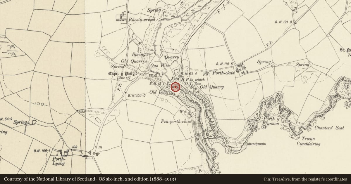
5 historical maps cover this location, the earliest the 1608 map "(13) Cambriae Typus." (David Rumsey Map Collection, Stanford Libraries).
Historical maps covering this location
- 1608 · (13) Cambriae Typus. (David Rumsey Map Collection, Stanford Libraries)
- 1636 · Cornubia : Devonia, Somersetus, Dorcestria, Wiltonia, Glocestria ... (David Rumsey Map Collection, Stanford Libraries)
- 1637 · Particular description of Wales. Cambria seu Wallia (David Rumsey Map Collection, Stanford Libraries)
- 1898 · 209 St David's (Hills) (David Rumsey Map Collection, Stanford Libraries)
- 1901 · Sheet 13. (David Rumsey Map Collection, Stanford Libraries)
Cadw's description
Location
Built into bank on quay at upper end of harbour at Porthclais, some 20m from road bridge.
History
Date of construction uncertain, but an import of lime for burning is recorded as early as 1743. The four kilns at Porthclais were owned by C Allen in 1870, but were disused by 1906.
Marked on 1840 Tithe Map.
Exterior
Probably early C19. Pair of limekilns, restored ca1975. Some 3m high, rubble stone, circular, built out from bank with stone-faced ramp up from S and N' steps in wall to N of N kiln and in rubble wall between kilns. Kilns have high kiln-eyes of Dewisland type, with tapering heads up to stone lintels. Circular crucibles with low restored parapets and paved walkways around. Between the kilns, foundations of lime-burner's hut.
Reason for designation
Group value.
Nearby in the register
- One of a Pair of Limekilns on Western Side of SlipwayIndustrialunder 1 mi
- Footbridge adjacent to Road BridgeTransportunder 1 mi
- One of a Pair of Limelkilns on Eastern QuayIndustrialunder 1 mi
- One of a Pair of Limekilns on Eastern QuayIndustrialunder 1 mi
Other entries of the same register within about three miles of this one, by straight line.