Cof Cymru: National Historic Assets of Wales · Wales
Penberi/Penberry
St. David's and the Cathedral Close, Pembrokeshire, Wales
A Grade II listed building in Penberry, St. David's and the Cathedral Close, Pembrokeshire, designated on 28 July 1992.
The record
- Designation
- Listed building, Grade II
- Broad class
- Domestic
- Date of designation
- 28 July 1992
- Locality
- Penberry
- Community
- St. David's and the Cathedral Close
- Unitary authority
- Pembrokeshire
- Country
- Wales
- Coordinates
- 51.91442, -5.24491
- Cadw reference
- 12676
Slide toward Today to fade the historical sheet and see the modern map underneath.
David Rumsey Map Collection, Stanford LibrariesDavid Rumsey Map Collection, Stanford LibrariesDavid Rumsey Map Collection, Stanford LibrariesDavid Rumsey Map Collection, Stanford LibrariesDavid Rumsey Map Collection, Stanford Libraries
5 historical maps cover this location, the earliest the 1608 map "(13) Cambriae Typus." (David Rumsey Map Collection, Stanford Libraries).
Historical maps covering this location
- 1608 · (13) Cambriae Typus. (David Rumsey Map Collection, Stanford Libraries)
- 1636 · Cornubia : Devonia, Somersetus, Dorcestria, Wiltonia, Glocestria ... (David Rumsey Map Collection, Stanford Libraries)
- 1637 · Particular description of Wales. Cambria seu Wallia (David Rumsey Map Collection, Stanford Libraries)
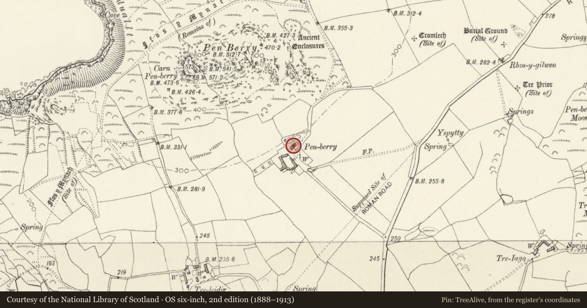
- 1898 · 209 St David's (Hills) (David Rumsey Map Collection, Stanford Libraries)
- 1901 · Sheet 13. (David Rumsey Map Collection, Stanford Libraries)
Cadw's description
Location
Situated down drive running NW from western side of Saint David's to Llanrhian road, about 1.5km N of Rhodiad.
Exterior
Early to mid C19 large farmhouse in whitewashed roughcast rubble with slate roofs and purple Caerbwdy stone stacks. Main house has two-storey three-window front with C20 plate glass sashes and centre door with overlight. Ground floor right has large C19 canted timber bay with low roughcast base, 4-pane sashes, moulded cornice and fishscale slate roof. Outshut rear. Lower two-storey service wing attached to left with square rubble W stack and rubble stone W end wall without side stone stairs to loft door. Whitewashed roughcast front with two 4-pane windows above and two ground floor C20 metal windows each side of centre C20 door.
Main house has large terraced front garden behind whitewashed rubble wall with C20 pierced concrete block wall above.
Reason for designation
Marked on 1840 Tithe Map.
A substantial traditional farmhouse in prominent site on slope of Carn Penberry.
Nearby in the register
- Hendre EynonDomesticunder 1 mi
- Gwrhyd GanolDomesticunder 1 mi
- Coach House to SW of Temynydd FarwDomesticunder 1 mi
- Tremynydd FawrDomesticunder 1 mi
Other entries of the same register within about three miles of this one, by straight line.