Cof Cymru: National Historic Assets of Wales · Wales
Coach House to SW of Temynydd Farw
St. David's and the Cathedral Close, Pembrokeshire, Wales
A Grade II listed building in Waun-y-Beddau, St. David's and the Cathedral Close, Pembrokeshire, designated on 28 July 1992.
The record
- Designation
- Listed building, Grade II
- Broad class
- Domestic
- Date of designation
- 28 July 1992
- Locality
- Waun-y-Beddau
- Community
- St. David's and the Cathedral Close
- Unitary authority
- Pembrokeshire
- Country
- Wales
- Coordinates
- 51.92335, -5.23056
- Cadw reference
- 12743
Slide toward Today to fade the historical sheet and see the modern map underneath.
David Rumsey Map Collection, Stanford LibrariesDavid Rumsey Map Collection, Stanford LibrariesDavid Rumsey Map Collection, Stanford LibrariesDavid Rumsey Map Collection, Stanford LibrariesDavid Rumsey Map Collection, Stanford Libraries
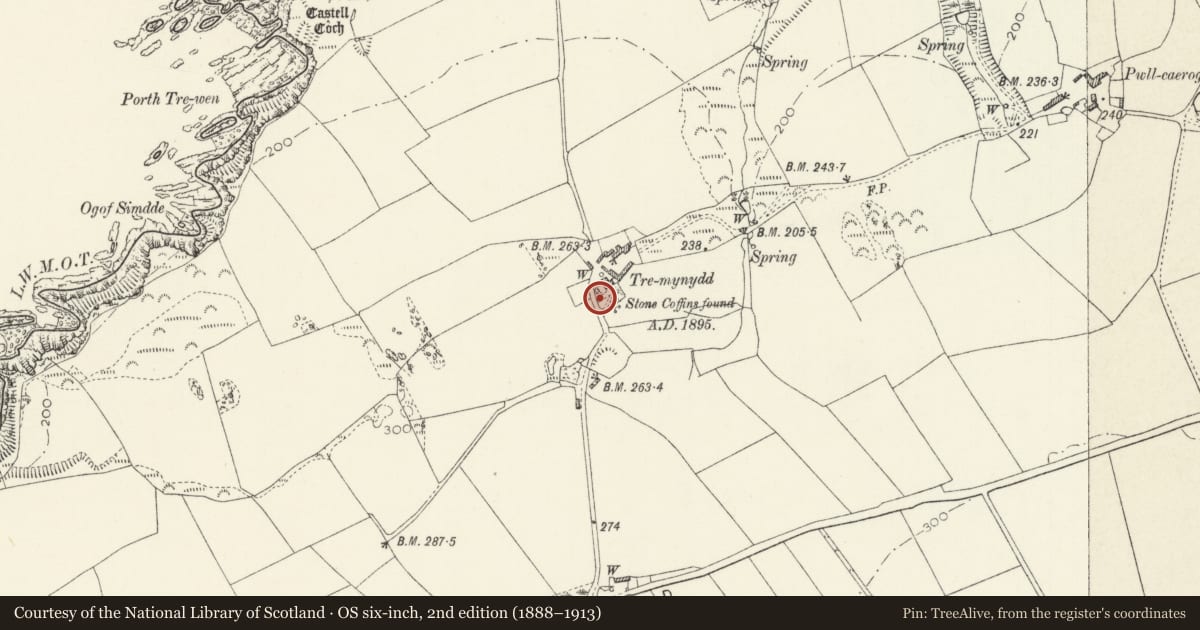
5 historical maps cover this location, the earliest the 1608 map "(13) Cambriae Typus." (David Rumsey Map Collection, Stanford Libraries).
Historical maps covering this location
- 1608 · (13) Cambriae Typus. (David Rumsey Map Collection, Stanford Libraries)
- 1636 · Cornubia : Devonia, Somersetus, Dorcestria, Wiltonia, Glocestria ... (David Rumsey Map Collection, Stanford Libraries)
- 1637 · Particular description of Wales. Cambria seu Wallia (David Rumsey Map Collection, Stanford Libraries)
- 1898 · 209 St David's (Hills) (David Rumsey Map Collection, Stanford Libraries)
- 1901 · Sheet 13. (David Rumsey Map Collection, Stanford Libraries)
Cadw's description
Location
Situated at SW angle of front garden, backing onto drive and adjoining gate to former front drive.
Exterior
C19 rubble stone coach-house, formerly with loft, and with low-pitched corrugated iron roof. E front gable of large roughly-squared stones, cut-stone voussoirs to flattened arch of entry. Wooden double doors. Small-paned window above with slate sill. Plain N wall, curved NW angle. Small walled enclosure on S side.
Reason for designation
Not marked on 1840 Tithe Map.
Group value with house and outbuildings.
Nearby in the register
- Tremynydd FawrDomesticunder 1 mi
- Range of Outbuildings to NW.of Tremynydd FawrAgriculture and Subsistenceunder 1 mi
- Outbuildings at E.end of N.Farmyard Range at Tremynydd FawrAgriculture and Subsistenceunder 1 mi
- Castell Coch Promontory Fort (by Ynys Gwair)Promontory Fort - coastalunder 1 mi
Other entries of the same register within about three miles of this one, by straight line.