Cof Cymru: National Historic Assets of Wales · Wales
Vaulted Chamber in Earth Bank to W. of Trewellwell
St. David's and the Cathedral Close, Pembrokeshire, Wales
A Grade II listed building in Caerfarchell, St. David's and the Cathedral Close, Pembrokeshire, designated on 28 July 1992.
The record
- Designation
- Listed building, Grade II
- Broad class
- Domestic
- Date of designation
- 28 July 1992
- Locality
- Caerfarchell
- Community
- St. David's and the Cathedral Close
- Unitary authority
- Pembrokeshire
- Country
- Wales
- Coordinates
- 51.89755, -5.20126
- Cadw reference
- 12671
Slide toward Today to fade the historical sheet and see the modern map underneath.
David Rumsey Map Collection, Stanford LibrariesDavid Rumsey Map Collection, Stanford LibrariesDavid Rumsey Map Collection, Stanford LibrariesDavid Rumsey Map Collection, Stanford LibrariesDavid Rumsey Map Collection, Stanford Libraries
5 historical maps cover this location, the earliest the 1608 map "(13) Cambriae Typus." (David Rumsey Map Collection, Stanford Libraries).
Historical maps covering this location
- 1608 · (13) Cambriae Typus. (David Rumsey Map Collection, Stanford Libraries)
- 1636 · Cornubia : Devonia, Somersetus, Dorcestria, Wiltonia, Glocestria ... (David Rumsey Map Collection, Stanford Libraries)
- 1637 · Particular description of Wales. Cambria seu Wallia (David Rumsey Map Collection, Stanford Libraries)
- 1898 · 209 St David's (Hills) (David Rumsey Map Collection, Stanford Libraries)
- 1901 · Sheet 13. (David Rumsey Map Collection, Stanford Libraries)
Cadw's description
Location
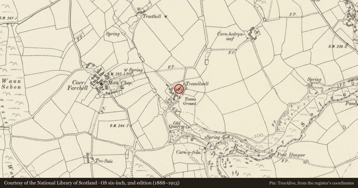
Situated across yard from house which is situated down drive running E from junction some 400m S of Caerfarchell.
History
Uncertain date, possibly C19,
Exterior
Small pointed tunnel vaulted chamber in rubble faced earth bank with low entry under stone lintel. Inner chamber is some 2m long by 1m wide and has seat at N end and vent loop at S end where retaining wall returns W.
The purpose is unknown, the structure seems unusually well built for an animal shelter or potato store and has a seat within.
Reason for designation
Trewellwell is marked on 1840 Tithe Map as owned and occupied by Rev Thomas Mortimer.
Nearby in the register
- Caer Farchell Farmhouse, including rear court with seatDomesticunder 1 mi
- Y Post/The Old Post OfficeDomesticunder 1 mi
- Outbuilding to rear of Caerfarchell FarmhouseAgriculture and Subsistenceunder 1 mi
- Outbuilding to E. of Hamilton HouseDomesticunder 1 mi
Other entries of the same register within about three miles of this one, by straight line.