Cof Cymru: National Historic Assets of Wales · Wales
The Manse, including Pigsty attached at N.End
St. David's and the Cathedral Close, Pembrokeshire, Wales
A Grade II listed building in Caerfarchell, St. David's and the Cathedral Close, Pembrokeshire, designated on 28 July 1992.
The record
- Designation
- Listed building, Grade II
- Broad class
- Domestic
- Date of designation
- 28 July 1992
- Locality
- Caerfarchell
- Community
- St. David's and the Cathedral Close
- Unitary authority
- Pembrokeshire
- Country
- Wales
- Coordinates
- 51.89806, -5.20707
- Cadw reference
- 12665
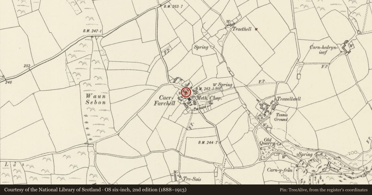
Slide toward Today to fade the historical sheet and see the modern map underneath.
David Rumsey Map Collection, Stanford LibrariesDavid Rumsey Map Collection, Stanford LibrariesDavid Rumsey Map Collection, Stanford LibrariesDavid Rumsey Map Collection, Stanford LibrariesDavid Rumsey Map Collection, Stanford Libraries
5 historical maps cover this location, the earliest the 1608 map "(13) Cambriae Typus." (David Rumsey Map Collection, Stanford Libraries).
Historical maps covering this location
- 1608 · (13) Cambriae Typus. (David Rumsey Map Collection, Stanford Libraries)
- 1636 · Cornubia : Devonia, Somersetus, Dorcestria, Wiltonia, Glocestria ... (David Rumsey Map Collection, Stanford Libraries)
- 1637 · Particular description of Wales. Cambria seu Wallia (David Rumsey Map Collection, Stanford Libraries)
- 1898 · 209 St David's (Hills) (David Rumsey Map Collection, Stanford Libraries)
- 1901 · Sheet 13. (David Rumsey Map Collection, Stanford Libraries)
Cadw's description
Location
Situated on western side of lane through village, across lane from Hamilton House.
Exterior
Circa 1870-75 manse probably built for J Griffiths, first resident minister 1873-5. Green Middle Mill rubble with grouted slate roof and brick end stacks. Two storey three-window elevation of 12-pane sashes with painted brick cambered heads and slate sills. Centre 3-panel door with traceried overlight, raised cement side piers and shallow cemented hood. Rear has central pointed-arched stair light with stained glass margins, 12-pane sashes each side on both floors. Single storey NW rear wing with door and boarded window. Pig-sty attached at N end with front enclosing wall.
In front of house low rubble stone garden wall with square gate piers and wooden gate.
Prominently sited, enclosing northern end of village group.
Nearby in the register
- Outbuilding to rear of the ManseDomesticunder 1 mi
- Hamilton HouseDomesticunder 1 mi
- Capel Caerfarchell & Outbuilding to NE corner of ForecourtReligious, Ritual and Funeraryunder 1 mi
- Range of outbuildings to rear of Hamilton HouseDomesticunder 1 mi
Other entries of the same register within about three miles of this one, by straight line.