Cof Cymru: National Historic Assets of Wales · Wales
Plyg Y Tywyn
St. David's and the Cathedral Close, Pembrokeshire, Wales
A Grade II listed building in The Burrows, St. David's and the Cathedral Close, Pembrokeshire, designated on 28 July 1992.
The record
- Designation
- Listed building, Grade II
- Broad class
- Domestic
- Date of designation
- 28 July 1992
- Locality
- The Burrows
- Community
- St. David's and the Cathedral Close
- Unitary authority
- Pembrokeshire
- Country
- Wales
- Coordinates
- 51.89059, -5.29204
- Cadw reference
- 12660
Slide toward Today to fade the historical sheet and see the modern map underneath.
David Rumsey Map Collection, Stanford LibrariesDavid Rumsey Map Collection, Stanford LibrariesDavid Rumsey Map Collection, Stanford LibrariesDavid Rumsey Map Collection, Stanford LibrariesDavid Rumsey Map Collection, Stanford Libraries
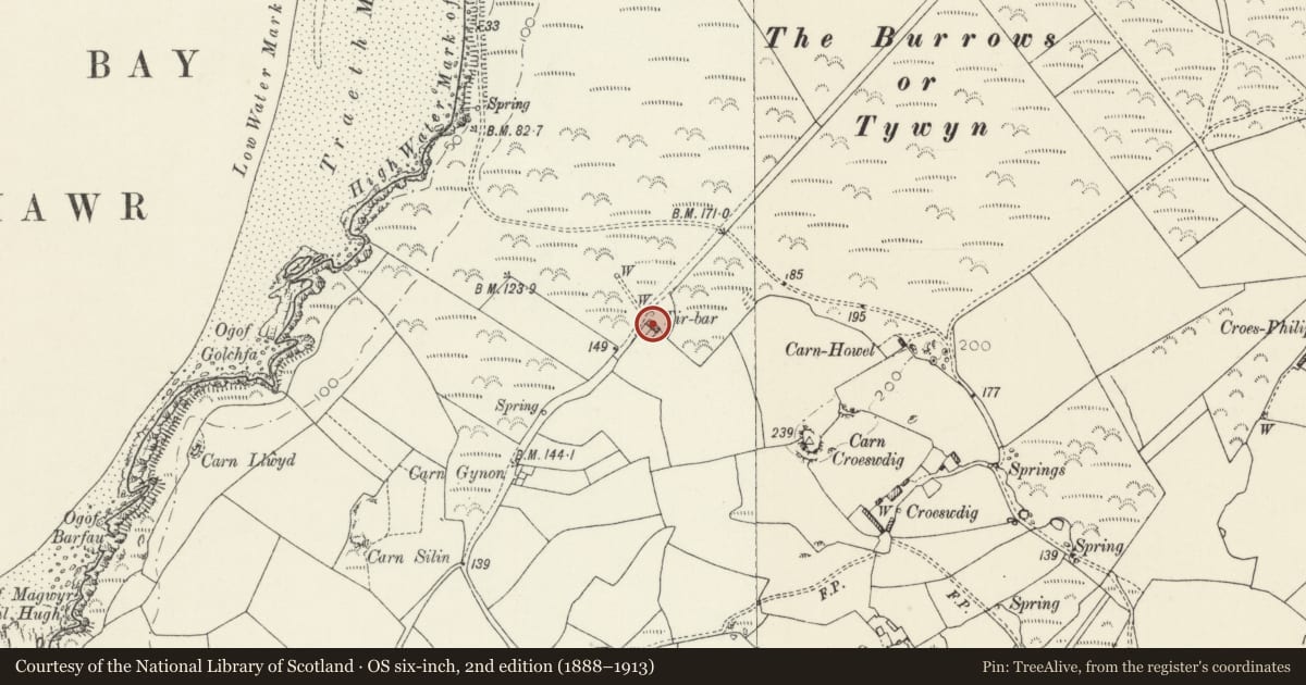
5 historical maps cover this location, the earliest the 1608 map "(13) Cambriae Typus." (David Rumsey Map Collection, Stanford Libraries).
Historical maps covering this location
- 1608 · (13) Cambriae Typus. (David Rumsey Map Collection, Stanford Libraries)
- 1636 · Cornubia : Devonia, Somersetus, Dorcestria, Wiltonia, Glocestria ... (David Rumsey Map Collection, Stanford Libraries)
- 1637 · Particular description of Wales. Cambria seu Wallia (David Rumsey Map Collection, Stanford Libraries)
- 1898 · 209 St David's (Hills) (David Rumsey Map Collection, Stanford Libraries)
- 1901 · Sheet 13. (David Rumsey Map Collection, Stanford Libraries)
Cadw's description
Location
Situated on SE side of dead-end lane running SW from Whitesands Bay road at Towyn Cottage, and about 300m SW of Whitesands Bay Hotel.
History
Early C19 cottage altered 1900.
Exterior
Whitewashed rubble stone with small slates to roof. Single storey with W end stone stack and large square stone ridge stack. Front roof is carried down low over open four bay verandah with square stone piers, added ca 1900. Within verandah, half-glazed door to left, then 12-pane sash and small 4-pane window, then three half-glazed doors. Left half of the house has fireplaces, that to E with big timber-lintelled inglenook. Rear has porch to right, 4-pane sash, and three windows beyond. West end wall has two 8-pane sashes.
Reason for designation
Marked on 1840 Tithe Map.
Included as good surviving example of single storey house; the deep verandah plus grey slates is an unusual and well-designed later change.
Nearby in the register
- Outbuilding on N.Side of Farmyard at CroeswdigAgriculture and Subsistenceunder 1 mi
- Croeswdig TreleddynDomesticunder 1 mi
- Range of outbuildings on W.side of Farmyard at CroeswdigAgriculture and Subsistenceunder 1 mi
- Outbuilding to E. of CroeswdigAgriculture and Subsistenceunder 1 mi
Other entries of the same register within about three miles of this one, by straight line.