Cof Cymru: National Historic Assets of Wales · Wales
The Hollies Cottage
Llangollen, Denbighshire, Wales
A Grade II listed building in Pen-y-Coed, Llangollen, Denbighshire, designated on 22 December 1989.
The record
- Designation
- Listed building, Grade II
- Broad class
- Domestic
- Date of designation
- 22 December 1989
- Locality
- Pen-y-Coed
- Community
- Llangollen
- Unitary authority
- Denbighshire
- Country
- Wales
- Coordinates
- 52.96894, -3.15876
- Cadw reference
- 1265
Slide toward Today to fade the historical sheet and see the modern map underneath.
David Rumsey Map Collection, Stanford LibrariesDavid Rumsey Map Collection, Stanford LibrariesDavid Rumsey Map Collection, Stanford LibrariesDavid Rumsey Map Collection, Stanford LibrariesLlyfrgell Genedlaethol Cymru – The National Library of Wales
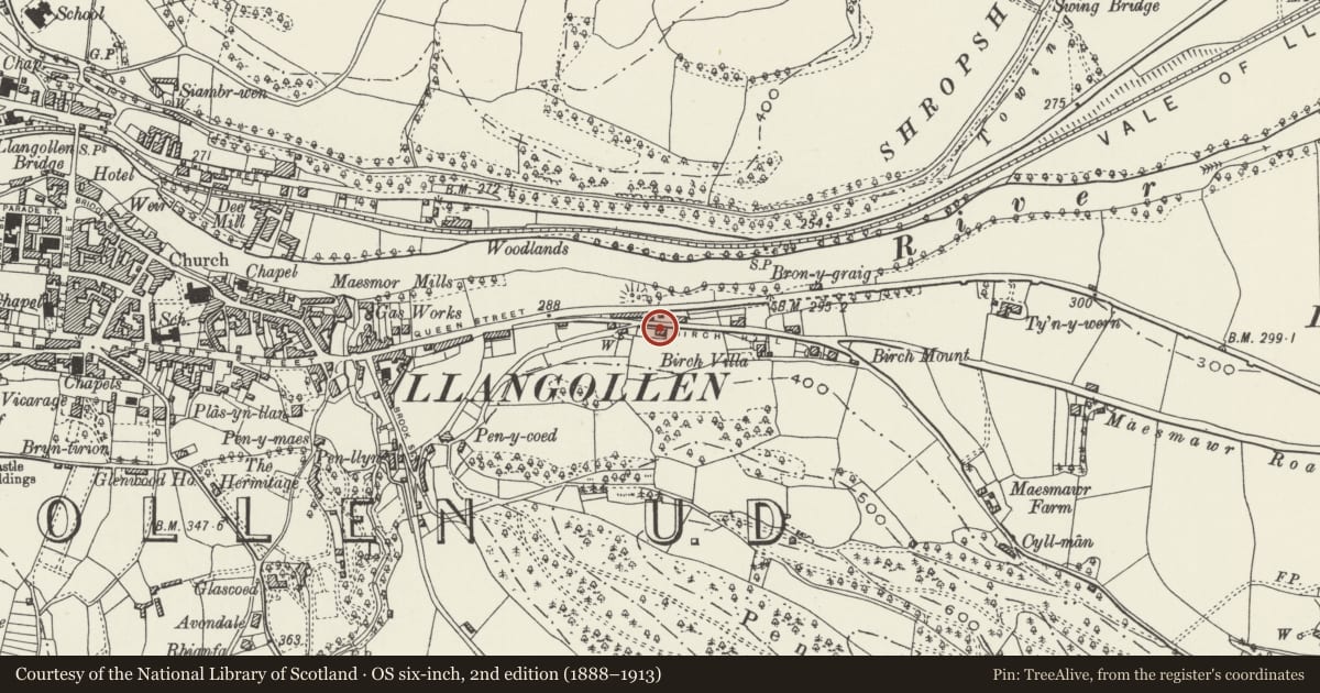
5 historical maps cover this location, the earliest the 1795 map "To Sir Watkin Williams-Wynn Bart ... the map of the six counties of North Wales is most humbly inscribed by his obedient humble servant" (Llyfrgell Genedlaethol Cymru – The National Library of Wales).
Historical maps covering this location
- 1795 · To Sir Watkin Williams-Wynn Bart ... the map of the six counties of North Wales is most… (Llyfrgell Genedlaethol Cymru – The National Library of Wales)
- 1883 · Watershed map England, Wales 3. (David Rumsey Map Collection, Stanford Libraries)
- 1898 · 121 Wrexham (Hills) (David Rumsey Map Collection, Stanford Libraries)
- 1898 · 121 Wrexham (Outline) (David Rumsey Map Collection, Stanford Libraries)
- 1901 · Sheet 9 and 10. (David Rumsey Map Collection, Stanford Libraries)
Cadw's description
Location
Just off Birch Hill at the bottom of the lane leading to Bryntirion Terrace. Set in slope.
Exterior
Largely earlier C19 Gothick 2-storey 4-window painted roughcast front incorporating slightly advanced 1-window lean-to at left and possibly later stepped up 1-window range to right. Slate roof and dentil eaves to right; 2 red brick chimney stacks. Central part has small acutely pointed casement windows with marginal glazing bars. Less ornate glazing to larger Gothick windows in right hand range. Simple casement with cambered heads to lean-to range incorporating boarded door. 6-panel main door, part glazed. No windows to rear.
Reason for designation
Group value with Nos 5 and 6 and Armstrong Towers.
Nearby in the register
- CerrigDomesticunder 1 mi
- Y BrynDomesticunder 1 mi
- Armstrong TowersDomesticunder 1 mi
- HighcroftDomesticunder 1 mi
Other entries of the same register within about three miles of this one, by straight line.