Cof Cymru: National Historic Assets of Wales · Wales
Armstrong Towers
Llangollen, Denbighshire, Wales
A Grade II listed building in Pen-y-Coed, Llangollen, Denbighshire, designated on 22 December 1989.
The record
- Designation
- Listed building, Grade II
- Broad class
- Domestic
- Date of designation
- 22 December 1989
- Locality
- Pen-y-Coed
- Community
- Llangollen
- Unitary authority
- Denbighshire
- Country
- Wales
- Coordinates
- 52.96909, -3.15837
- Cadw reference
- 1262
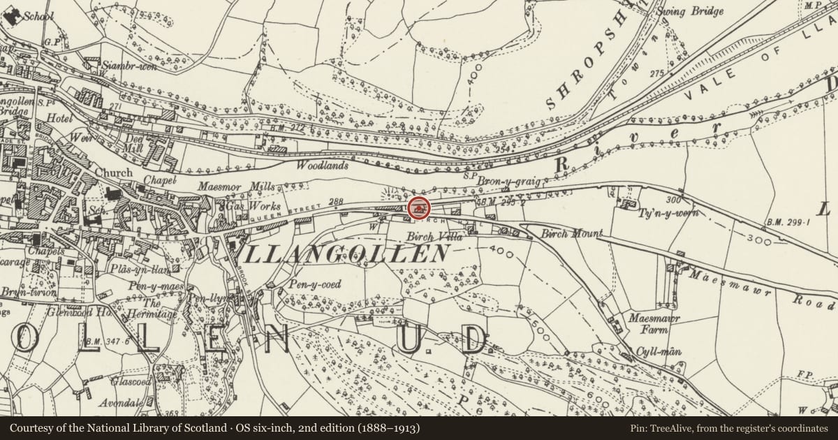
Slide toward Today to fade the historical sheet and see the modern map underneath.
David Rumsey Map Collection, Stanford LibrariesDavid Rumsey Map Collection, Stanford LibrariesDavid Rumsey Map Collection, Stanford LibrariesDavid Rumsey Map Collection, Stanford LibrariesLlyfrgell Genedlaethol Cymru – The National Library of Wales
5 historical maps cover this location, the earliest the 1795 map "To Sir Watkin Williams-Wynn Bart ... the map of the six counties of North Wales is most humbly inscribed by his obedient humble servant" (Llyfrgell Genedlaethol Cymru – The National Library of Wales).
Historical maps covering this location
- 1795 · To Sir Watkin Williams-Wynn Bart ... the map of the six counties of North Wales is most… (Llyfrgell Genedlaethol Cymru – The National Library of Wales)
- 1883 · Watershed map England, Wales 3. (David Rumsey Map Collection, Stanford Libraries)
- 1898 · 121 Wrexham (Hills) (David Rumsey Map Collection, Stanford Libraries)
- 1898 · 121 Wrexham (Outline) (David Rumsey Map Collection, Stanford Libraries)
- 1901 · Sheet 9 and 10. (David Rumsey Map Collection, Stanford Libraries)
Cadw's description
Location
Set in the slope forward to the street.
History
C18 origins; refronted and extended to rear in early to mid C19. The House name is modern.
Exterior
2-storey 3-window symmetrical front of unusual picturesque Gothick design; painted roughcast with plinth and painted end pilasters. Slate roof and cement render end chimney stacks; eaves band. Broad small pane sash windows in acutely pointed openings; to the 1st floor the heads of the upper sashes have diamond glazing and kite shaped tracery - same design to the fanlights over ground floor windows. 16-pane sash to centre over gabled porch with glazed door. Low flat roof extension to left. 3-window rear with flat roof dormers, 9-pane 1st floor sashes and ground floor splayed bays and porch.
Interior
The interior has some inserted ceiling beams to hall and simple C19 staircase; no Gothick detail.
Reason for designation
Group value with The Hollies Cottage and Nos 5 and 6.
Nearby in the register
- The Hollies CottageDomesticunder 1 mi
- CerrigDomesticunder 1 mi
- Y BrynDomesticunder 1 mi
- HighcroftDomesticunder 1 mi
Other entries of the same register within about three miles of this one, by straight line.