Cof Cymru: National Historic Assets of Wales · Wales
Manor House
St. David's and the Cathedral Close, Pembrokeshire, Wales
A Grade II listed building in St. David's and the Cathedral Close, Pembrokeshire, designated on 26 August 1981.
The record
- Designation
- Listed building, Grade II
- Broad class
- Domestic
- Date of designation
- 26 August 1981
- Community
- St. David's and the Cathedral Close
- Unitary authority
- Pembrokeshire
- Country
- Wales
- Coordinates
- 51.88097, -5.26391
- Cadw reference
- 12610
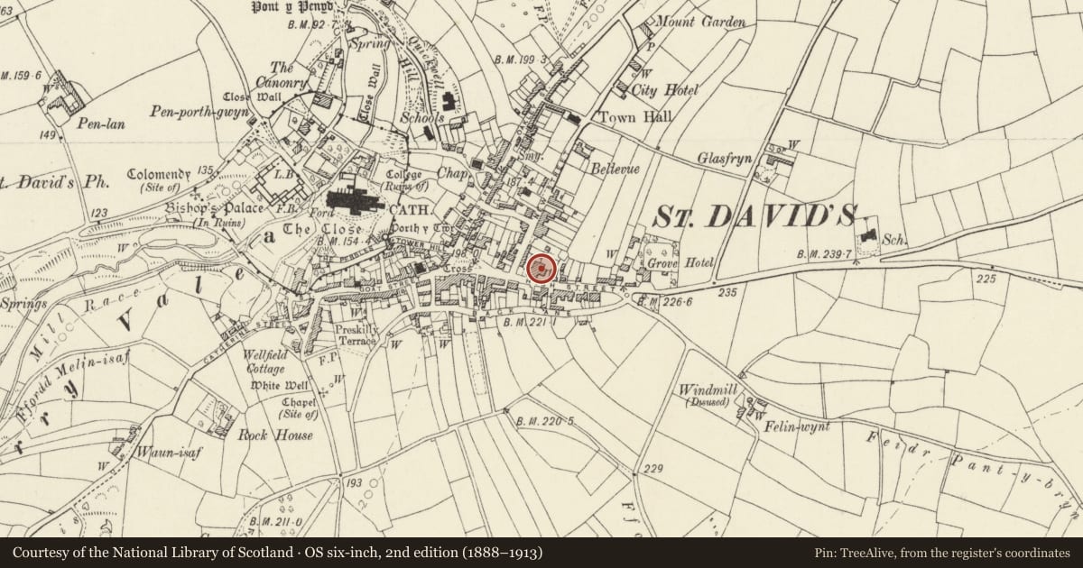
Slide toward Today to fade the historical sheet and see the modern map underneath.
David Rumsey Map Collection, Stanford LibrariesDavid Rumsey Map Collection, Stanford LibrariesDavid Rumsey Map Collection, Stanford LibrariesDavid Rumsey Map Collection, Stanford LibrariesDavid Rumsey Map Collection, Stanford Libraries
5 historical maps cover this location, the earliest the 1608 map "(13) Cambriae Typus." (David Rumsey Map Collection, Stanford Libraries).
Historical maps covering this location
- 1608 · (13) Cambriae Typus. (David Rumsey Map Collection, Stanford Libraries)
- 1636 · Cornubia : Devonia, Somersetus, Dorcestria, Wiltonia, Glocestria ... (David Rumsey Map Collection, Stanford Libraries)
- 1637 · Particular description of Wales. Cambria seu Wallia (David Rumsey Map Collection, Stanford Libraries)
- 1898 · 209 St David's (Hills) (David Rumsey Map Collection, Stanford Libraries)
- 1901 · Sheet 13. (David Rumsey Map Collection, Stanford Libraries)
Cadw's description
Location
Detached house set back, immediately E of No 15 High Street.
Exterior
Early to mid C19 house in painted roughcast with raised cement dressings and slate valley roof with close-spaced timber eaves brackets and carved bargeboards to W end paired gables. Painted rendered end stacks. Two-storey three window street front has raised cement strips to plinth, angles, eaves and around windows; three square 6-pane sashes above, two 12-pane sashes below with no centre feature. Door with sash window adjoining and two sashes above in each end wall and altered NW low rear wing, partly obscured by C20 NE addition to main house.
Reason for designation
Similar house design with no centre window or door to Vicarage at Whitchurch of 1842, by J Williams of Solva; but this house is earlier, marked on 1840 Tithe Map as owned by Rev. W Richardson, canon of the cathedral. Said to have been a private school run by Dr Propert in C19.
Group value.
Nearby in the register
- 20 High StreetCommercialunder 1 mi
- 18 High StreetCommercialunder 1 mi
- City BakeryNo class recordedunder 1 mi
- 8 High StreetDomesticunder 1 mi
Other entries of the same register within about three miles of this one, by straight line.