Cof Cymru: National Historic Assets of Wales · Wales
Warehouse occupied by St David's Assemblies
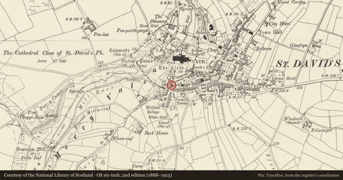
St. David's and the Cathedral Close, Pembrokeshire, Wales
A Grade II listed building in St. David's and the Cathedral Close, Pembrokeshire, designated on 26 August 1981.
The record
- Designation
- Listed building, Grade II
- Broad class
- Commercial
- Date of designation
- 26 August 1981
- Community
- St. David's and the Cathedral Close
- Unitary authority
- Pembrokeshire
- Country
- Wales
- Coordinates
- 51.88074, -5.26911
- Cadw reference
- 12596
Slide toward Today to fade the historical sheet and see the modern map underneath.
David Rumsey Map Collection, Stanford LibrariesDavid Rumsey Map Collection, Stanford LibrariesDavid Rumsey Map Collection, Stanford LibrariesDavid Rumsey Map Collection, Stanford LibrariesDavid Rumsey Map Collection, Stanford Libraries
5 historical maps cover this location, the earliest the 1608 map "(13) Cambriae Typus." (David Rumsey Map Collection, Stanford Libraries).
Historical maps covering this location
- 1608 · (13) Cambriae Typus. (David Rumsey Map Collection, Stanford Libraries)
- 1636 · Cornubia : Devonia, Somersetus, Dorcestria, Wiltonia, Glocestria ... (David Rumsey Map Collection, Stanford Libraries)
- 1637 · Particular description of Wales. Cambria seu Wallia (David Rumsey Map Collection, Stanford Libraries)
- 1898 · 209 St David's (Hills) (David Rumsey Map Collection, Stanford Libraries)
- 1901 · Sheet 13. (David Rumsey Map Collection, Stanford Libraries)
Cadw's description
Location
Situated at western end of Goat Street, at junction with Pit Street.
History
C18 or early C19 warehouse (said to be dated 1758) associated with the coastal trade at Porthclais, converted as industrial premises in later C20.
Exterior
Rubble stone with slate gabled roof (grouted slate 1981) and end stacks; stone to W, brick to E. Three-storey four-window range with modern timber windows throughout. Four small windows under eaves to second floor, first floor central large square-headed opening with modern fixed glazing and window each side; ground floor large central doorway with concrete lintel and window, not aligned, each side.
Single storey range attached to W with stone walls, roof reslated since 1981 and windows with brick sides and modern timber casements.
Reason for designation
Prominently sited and of importance as one of the three surviving warehouses that served the coastal trade at Saint David's. Old photographs show 4 windows on first floor as on second floor. The building is said to be dated 1758 but date stone not seen on resurvey.
Nearby in the register
- The Close Wall (formerly listed with Porth Y Twr)Religious, Ritual and Funeraryunder 1 mi
- Coach House to the DeaneryDomesticunder 1 mi
- Warehouse between Merrivale & No.2 Catherine StreetCommercialunder 1 mi
- 37 Goat StreetDomesticunder 1 mi
Other entries of the same register within about three miles of this one, by straight line.