Cof Cymru: National Historic Assets of Wales · Wales
Coach House to the Deanery
St. David's and the Cathedral Close, Pembrokeshire, Wales
A Grade II listed building in St. David's and the Cathedral Close, Pembrokeshire, designated on 26 August 1981.
The record
- Designation
- Listed building, Grade II
- Broad class
- Domestic
- Date of designation
- 26 August 1981
- Community
- St. David's and the Cathedral Close
- Unitary authority
- Pembrokeshire
- Country
- Wales
- Coordinates
- 51.88105, -5.26926
- Cadw reference
- 12547
Slide toward Today to fade the historical sheet and see the modern map underneath.
David Rumsey Map Collection, Stanford LibrariesDavid Rumsey Map Collection, Stanford LibrariesDavid Rumsey Map Collection, Stanford LibrariesDavid Rumsey Map Collection, Stanford LibrariesDavid Rumsey Map Collection, Stanford Libraries
5 historical maps cover this location, the earliest the 1608 map "(13) Cambriae Typus." (David Rumsey Map Collection, Stanford Libraries).
Historical maps covering this location
- 1608 · (13) Cambriae Typus. (David Rumsey Map Collection, Stanford Libraries)
- 1636 · Cornubia : Devonia, Somersetus, Dorcestria, Wiltonia, Glocestria ... (David Rumsey Map Collection, Stanford Libraries)
- 1637 · Particular description of Wales. Cambria seu Wallia (David Rumsey Map Collection, Stanford Libraries)
- 1898 · 209 St David's (Hills) (David Rumsey Map Collection, Stanford Libraries)
- 1901 · Sheet 13. (David Rumsey Map Collection, Stanford Libraries)
Cadw's description
Location
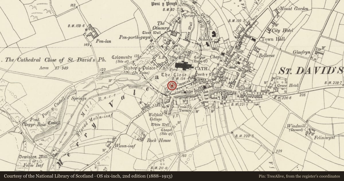
Situated NE of The Deanery at W end of The Pebbles, facing N.
Exterior
Mid C19 coach-house and stable in rubble stone with unpainted modern cement render to front and low pitched slate roof. Front wall to road blank except for at right side a broad segmental-arched coach entry with ledged double doors and ventilation slits; over left side of door a boarded loft opening under eaves. East gable end has ground floor tall door and window and loft door above. W end has one loft opening.
A building is shown on this site on 1840 Tithe Map but with two further sections to E, the whole marked as coach-yard and garden.
Reason for designation
Included for group value.
Nearby in the register
- The Close Wall (formerly listed with Porth Y Twr)Religious, Ritual and Funeraryunder 1 mi
- Warehouse occupied by St David's AssembliesCommercialunder 1 mi
- The Deanery including Garden Walls & GateDomesticunder 1 mi
- Churchyard Boundary Wall on N.side of the PebblesReligious, Ritual and Funeraryunder 1 mi
Other entries of the same register within about three miles of this one, by straight line.