Cof Cymru: National Historic Assets of Wales · Wales
Brecon House
St. David's and the Cathedral Close, Pembrokeshire, Wales
A Grade II listed building in St. David's and the Cathedral Close, Pembrokeshire, designated on 26 August 1981.
The record
- Designation
- Listed building, Grade II
- Broad class
- Domestic
- Date of designation
- 26 August 1981
- Community
- St. David's and the Cathedral Close
- Unitary authority
- Pembrokeshire
- Country
- Wales
- Coordinates
- 51.88302, -5.26957
- Cadw reference
- 12568
Slide toward Today to fade the historical sheet and see the modern map underneath.
David Rumsey Map Collection, Stanford LibrariesDavid Rumsey Map Collection, Stanford LibrariesDavid Rumsey Map Collection, Stanford LibrariesDavid Rumsey Map Collection, Stanford LibrariesDavid Rumsey Map Collection, Stanford Libraries
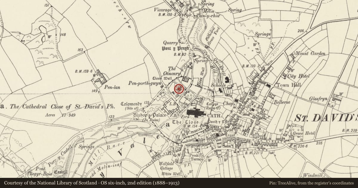
5 historical maps cover this location, the earliest the 1608 map "(13) Cambriae Typus." (David Rumsey Map Collection, Stanford Libraries).
Historical maps covering this location
- 1608 · (13) Cambriae Typus. (David Rumsey Map Collection, Stanford Libraries)
- 1636 · Cornubia : Devonia, Somersetus, Dorcestria, Wiltonia, Glocestria ... (David Rumsey Map Collection, Stanford Libraries)
- 1637 · Particular description of Wales. Cambria seu Wallia (David Rumsey Map Collection, Stanford Libraries)
- 1898 · 209 St David's (Hills) (David Rumsey Map Collection, Stanford Libraries)
- 1901 · Sheet 13. (David Rumsey Map Collection, Stanford Libraries)
Cadw's description
Location
Situated on NW side of road leading NE from Cathedral Close towards Pont y Penyd, between The Archdeaconry and The Canonry.
History
1820-21 by William Owen of Haverfordwest for the Archdeacon of Brecon. The house was rebuilt by W Owen of Haverfordwest, but the final account is signed "measured and examined, J W Maund, architect, Brecon", who may have had a hand in the design. The cost was £931/19/0+d. It replaces a fine C16 house described by E Yardley in mid C18 as having a 'hansome hall reching up to ye roof', and by Jones and Freeman as having had a remarkable large porch with sculpted shields and other devises. One carved escutcheon was extant in 1976.
Exterior
Roughcast unpainted two-storey, three-window front with low-pitched slate eaves roof, raised plinth and central front door reached by double flight of four stone steps with plain iron handrail. 12-pane sashes with slate sills, flush-panelled 6-panel door with traceried fanlight in painted, panelled, round-arched reveal; thin painted timber pilasters each side to semicircular painted timber hood on paired carved brackets. Plain 3-window W side elevation, a later C19 bay window removed since 1981. NE service range, set back.
Interior
Panelled doors, shutters, contemporary staircase, C19 fireplaces.
Reason for designation
Group value.
Nearby in the register
- Front Garden Wall & Gatepiers & Gate to Brecon HouseDomesticunder 1 mi
- Coach House to Brecon HouseDomesticunder 1 mi
- The Arch Deaconry (The Archdeacon of St David's House)Domesticunder 1 mi
- Coach House to The Arch DeaconryDomesticunder 1 mi
Other entries of the same register within about three miles of this one, by straight line.