Cof Cymru: National Historic Assets of Wales · Wales
The Bishop's Palace
St. David's and the Cathedral Close, Pembrokeshire, Wales
A Grade I listed building in St. David's and the Cathedral Close, Pembrokeshire, designated on 1 March 1963.
The record
- Designation
- Listed building, Grade I
- Broad class
- Religious, Ritual and Funerary
- Date of designation
- 1 March 1963
- Community
- St. David's and the Cathedral Close
- Unitary authority
- Pembrokeshire
- Country
- Wales
- Coordinates
- 51.88227, -5.27023
- Cadw reference
- 12558
Slide toward Today to fade the historical sheet and see the modern map underneath.
David Rumsey Map Collection, Stanford LibrariesDavid Rumsey Map Collection, Stanford LibrariesDavid Rumsey Map Collection, Stanford LibrariesDavid Rumsey Map Collection, Stanford LibrariesDavid Rumsey Map Collection, Stanford Libraries
5 historical maps cover this location, the earliest the 1608 map "(13) Cambriae Typus." (David Rumsey Map Collection, Stanford Libraries).
Historical maps covering this location
- 1608 · (13) Cambriae Typus. (David Rumsey Map Collection, Stanford Libraries)
- 1636 · Cornubia : Devonia, Somersetus, Dorcestria, Wiltonia, Glocestria ... (David Rumsey Map Collection, Stanford Libraries)
- 1637 · Particular description of Wales. Cambria seu Wallia (David Rumsey Map Collection, Stanford Libraries)
- 1898 · 209 St David's (Hills) (David Rumsey Map Collection, Stanford Libraries)
- 1901 · Sheet 13. (David Rumsey Map Collection, Stanford Libraries)
Cadw's description
Location
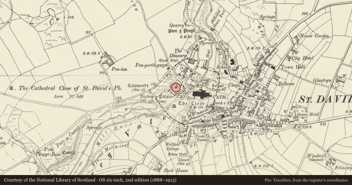
Situated W of the Cathedral on the opposite bank of the River Alun.
History
C12 to C16 bishop's palace, outstanding among the episcopal palaces of Britain, started about 1200 and substantially built under Bishop Bek (1280-96) and Bishop Gower (1328-47). The ruination of the palace began with the stripping of the lead from the Great Hall under Bishop Barlow (1536-48) and the whole is now roofless.
Exterior
A single large quadrangle with the principal buildings towards the S side, though the earliest surviving work is probably the NE enclosure wall and NW range. Entrance by plain late C13 gatehouse at left end of NE wall, with supposed private chapel of mid C14 adjoining, raised on vaulted undercroft. Late C13 Bishop's Hall on E side with the arcaded parapets associated with Bishop Gower's work (Lamphey Palace, Swansea Castle and Gower's Great Hall here). Carved gateway up broad flight of steps with semi-octagonal head characteristic of Gower's work and related to Bristol school. To N of Bishop's Hall is the solar, late C13, and to the S the kitchen, late C14. On S side is the great hall, mid C14, with striking ogee headed doorway, reached by broad flight of steps, long lancet windows and fine E end rose window. Arcaded parapet with varicoloured voussoirs. Late C14 bishop's chapel at W end with W bell turret. Domestic buildings and stables probably occupied W side of quadrangle. Late C15 or C16 wing SE of solar.
Scheduled Ancient Monument Pe 6.
Reason for designation
Group value.
Nearby in the register
- St Davids Bishop’s PalacePalaceunder 1 mi
- St Davids Cathedral Close: Close Wall and Sites of Former GatewaysWallunder 1 mi
- Front & Side Garden Wall & Gatepiers to The Arch DeaconryDomesticunder 1 mi
- The Arch Deaconry (The Archdeacon of St David's House)Domesticunder 1 mi
Other entries of the same register within about three miles of this one, by straight line.