Cof Cymru: National Historic Assets of Wales · Wales
Llwyngwair Mill
Newport, Pembrokeshire, Wales
A Grade II listed building in Newport, Pembrokeshire, designated on 14 April 1992.
The record
- Designation
- Listed building, Grade II
- Broad class
- Industrial
- Date of designation
- 14 April 1992
- Community
- Newport
- Unitary authority
- Pembrokeshire
- Country
- Wales
- Coordinates
- 52.01798, -4.81455
- Cadw reference
- 12525
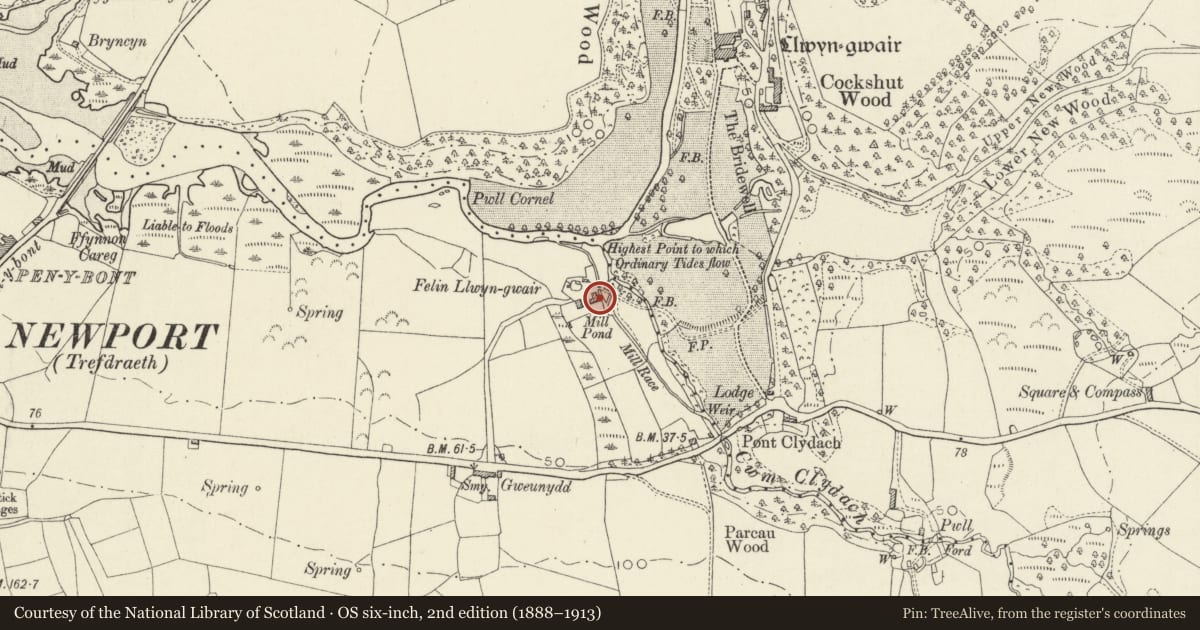
Slide toward Today to fade the historical sheet and see the modern map underneath.
David Rumsey Map Collection, Stanford LibrariesDavid Rumsey Map Collection, Stanford LibrariesDavid Rumsey Map Collection, Stanford LibrariesDavid Rumsey Map Collection, Stanford LibrariesDavid Rumsey Map Collection, Stanford Libraries
5 historical maps cover this location, the earliest the 1608 map "(13) Cambriae Typus." (David Rumsey Map Collection, Stanford Libraries).
Historical maps covering this location
- 1608 · (13) Cambriae Typus. (David Rumsey Map Collection, Stanford Libraries)
- 1891 · Sheet 10. Ordnance Survey of England and Wales. . (David Rumsey Map Collection, Stanford Libraries)
- 1898 · 210 Cardigan (Hills) (David Rumsey Map Collection, Stanford Libraries)
- 1898 · 210 Cardigan (Outline) (David Rumsey Map Collection, Stanford Libraries)
- 1901 · Sheet 13. (David Rumsey Map Collection, Stanford Libraries)
Cadw's description
Location
Situated down track N off A487 with junction some 400m W of Pont Clydach.
Exterior
Early to mid C19 water-mill, large rubble stone building with corrugated iron half-hipped roof. Two storey and loft. W end wall has ground floor centre door with cambered brick head and keystone part blocked for rubble stone outside steps to first floor off-centre door with damaged brick head. Upper door was formerly in gabled porch, now roofless. Loft light with cambered brick head and keystone. Brick band across at sill level. South side has 3 cambered-headed first floor small windows. North side has gabled and lofted attached building with grouted slate roof to right, centre door small window to left and one larger first floor window over, all with cambered brick heads and keystones.
East end wall has large iron and timber overshot water-wheel with ' Moss and Sons 1843 Carmarthen' stamped on rim, small first floor door and loft window above, with cambered brick heads. Leat from Afon Clydach coming in from south.
Interior
Interior loft floor has 8-bay roof, double purlin, originally 4 trusses, widely spaced. Three intermediate trusses added later.
Nearby in the register
- Lodge & Gatepiers to Llwyngwair Manor HotelDomesticunder 1 mi
- Llwyngwair Manor HotelCommercialunder 1 mi
- Coach House at Llwyngwair Manor HotelDomesticunder 1 mi
- Stables at Llwyngwair Manor HotelDomesticunder 1 mi
Other entries of the same register within about three miles of this one, by straight line.