Cof Cymru: National Historic Assets of Wales · Wales
Ty-Isa
Llangollen, Denbighshire, Wales
A Grade II listed building in Llangollen, Denbighshire, designated on 22 December 1989.
The record
- Designation
- Listed building, Grade II
- Broad class
- Domestic
- Date of designation
- 22 December 1989
- Community
- Llangollen
- Unitary authority
- Denbighshire
- Country
- Wales
- Coordinates
- 52.97451, -3.16891
- Cadw reference
- 1251
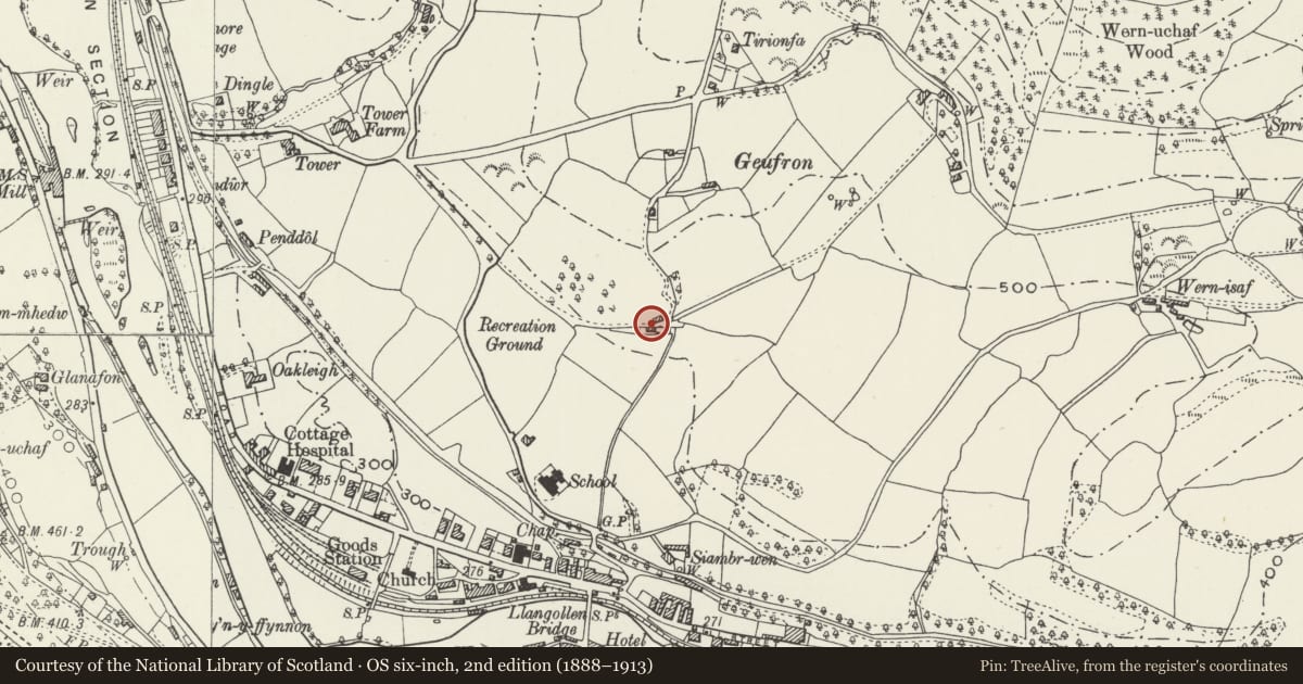
Slide toward Today to fade the historical sheet and see the modern map underneath.
David Rumsey Map Collection, Stanford LibrariesDavid Rumsey Map Collection, Stanford LibrariesDavid Rumsey Map Collection, Stanford LibrariesDavid Rumsey Map Collection, Stanford LibrariesLlyfrgell Genedlaethol Cymru – The National Library of Wales
5 historical maps cover this location, the earliest the 1795 map "To Sir Watkin Williams-Wynn Bart ... the map of the six counties of North Wales is most humbly inscribed by his obedient humble servant" (Llyfrgell Genedlaethol Cymru – The National Library of Wales).
Historical maps covering this location
- 1795 · To Sir Watkin Williams-Wynn Bart ... the map of the six counties of North Wales is most… (Llyfrgell Genedlaethol Cymru – The National Library of Wales)
- 1883 · Watershed map England, Wales 3. (David Rumsey Map Collection, Stanford Libraries)
- 1898 · 121 Wrexham (Hills) (David Rumsey Map Collection, Stanford Libraries)
- 1898 · 121 Wrexham (Outline) (David Rumsey Map Collection, Stanford Libraries)
- 1901 · Sheet 9 and 10. (David Rumsey Map Collection, Stanford Libraries)
Cadw's description
Location
Reached from Dinbren road. On S side of the lane to Geufron Hall, high above the town. The front now faces uphill towards Dinas Bran.
Exterior
Probably late C17 single storey and attic whitewashed rubble structure; later divided into two cottages - now one property. Undulating slate roof with overhanging eaves and rubble chimney stacks, with red brick caps, to E end and near the entrance. The S side, which was originally the front, has tall gabled dormers with 4-pane casements; 6 pane casements below with timber lintels. The E gable end with projecting chimney breast has window above modern door.
The W end has small pane casement window. The N side, now the front, has modern dormer off-centre over small pane windows, boarded door below the chimney stack and modern small-pane window to far right.
Interior
Lobby entry plan with service rooms to W. Deeply chamfered and stopped cross beams and similar fireplace lintel; joists also stop chamfered. Original roof structure; modern stairs.
Nearby in the register
- Canal MuseumTransportunder 1 mi
- Siambr WenDomesticunder 1 mi
- Wharf CottageDomesticunder 1 mi
- 4 Abbey SquareDomesticunder 1 mi
Other entries of the same register within about three miles of this one, by straight line.