Cof Cymru: National Historic Assets of Wales · Wales
Llys Meddyg
Newport, Pembrokeshire, Wales
A Grade II listed building in Newport, Pembrokeshire, designated on 14 April 1992.
The record
- Designation
- Listed building, Grade II
- Broad class
- Domestic
- Date of designation
- 14 April 1992
- Community
- Newport
- Unitary authority
- Pembrokeshire
- Country
- Wales
- Coordinates
- 52.01690, -4.83005
- Cadw reference
- 12487
Slide toward Today to fade the historical sheet and see the modern map underneath.
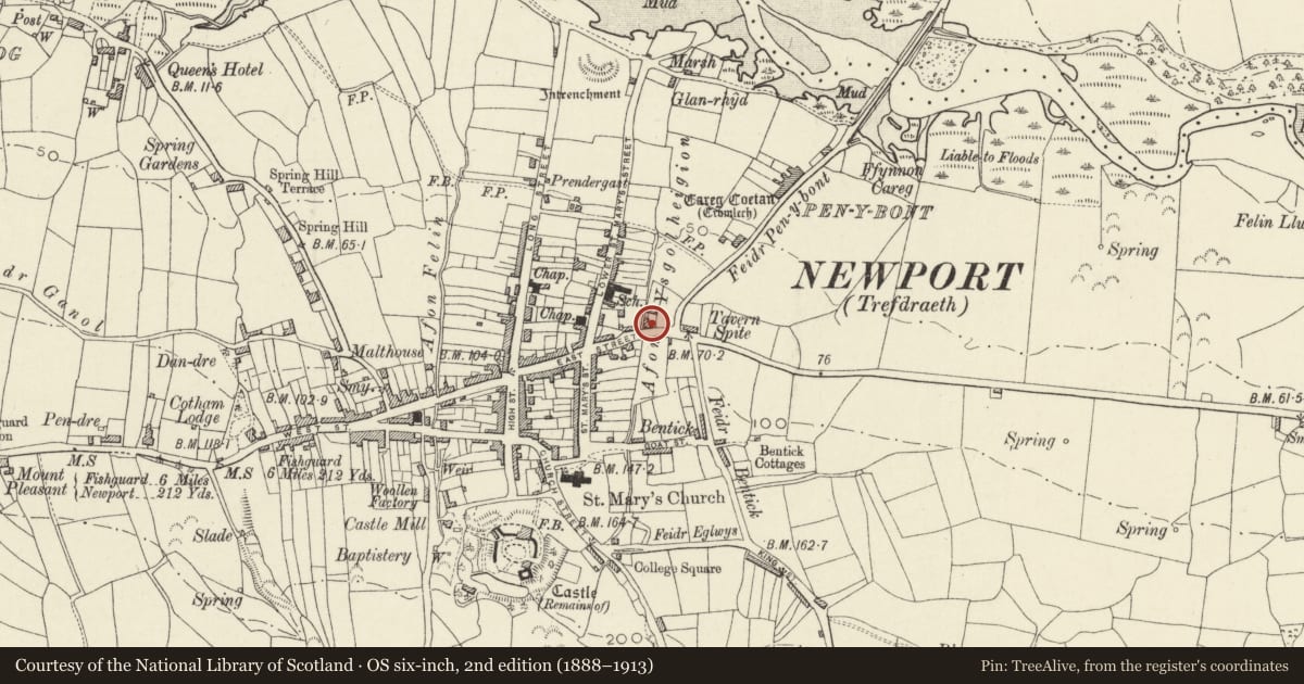
David Rumsey Map Collection, Stanford LibrariesDavid Rumsey Map Collection, Stanford LibrariesDavid Rumsey Map Collection, Stanford LibrariesDavid Rumsey Map Collection, Stanford LibrariesDavid Rumsey Map Collection, Stanford Libraries
5 historical maps cover this location, the earliest the 1608 map "(13) Cambriae Typus." (David Rumsey Map Collection, Stanford Libraries).
Historical maps covering this location
- 1608 · (13) Cambriae Typus. (David Rumsey Map Collection, Stanford Libraries)
- 1891 · Sheet 10. Ordnance Survey of England and Wales. . (David Rumsey Map Collection, Stanford Libraries)
- 1898 · 210 Cardigan (Hills) (David Rumsey Map Collection, Stanford Libraries)
- 1898 · 210 Cardigan (Outline) (David Rumsey Map Collection, Stanford Libraries)
- 1901 · Sheet 13. (David Rumsey Map Collection, Stanford Libraries)
Cadw's description
Location
Situated at eastern edge of town, some 40m W of junction with Feidr Penybont.
Exterior
Mid to later C19 substantial house in squared rubble stone with gabled slate roof and green stone end stacks. Two storeys and attic, 3-window front of large 16-pane sashes with painted slate sills and green stone voussoirs to ground floor windows. Centre 4-panel door with margin-glazed overlight. Later C19 heavy ashlar porch, 2 columns with Gothic caps, pilaster responds, cornice, parapet with pierced cusped roundels, corner pedestal blocks with urn finials and scrolled name block over parapet centre.
End wall pair of loft windows, W side basement with door and 3 windows, 2 ground floor 12 pane sashes, one to first floor. E side has one ground floor 16-pane sash.
Front garden enclosed by whitewashed brick dwarf walls with cast-iron arcaded rails and finials. Curved SE angle.
Reason for designation
A good example of the larger town house in the region, and prominent on the eastern approach to Newport.
Nearby in the register
- Ebenezer Congregational Chapel (Capel Ebenezer)Religious, Ritual and Funeraryunder 1 mi
- Ivy House (The Cnapan Restaurant)Commercialunder 1 mi
- The Sessions HouseCommercialunder 1 mi
- Bank TerraceDomesticunder 1 mi
Other entries of the same register within about three miles of this one, by straight line.