Cof Cymru: National Historic Assets of Wales · Wales
Outbuilding attached at SW.Angle to walled garden at Trevacoon
Llanrhian, Pembrokeshire, Wales
A Grade II listed building in Llanrhian, Pembrokeshire, designated on 1 March 1963.
The record
- Designation
- Listed building, Grade II
- Broad class
- Domestic
- Date of designation
- 1 March 1963
- Community
- Llanrhian
- Unitary authority
- Pembrokeshire
- Country
- Wales
- Coordinates
- 51.93245, -5.18034
- Cadw reference
- 12398
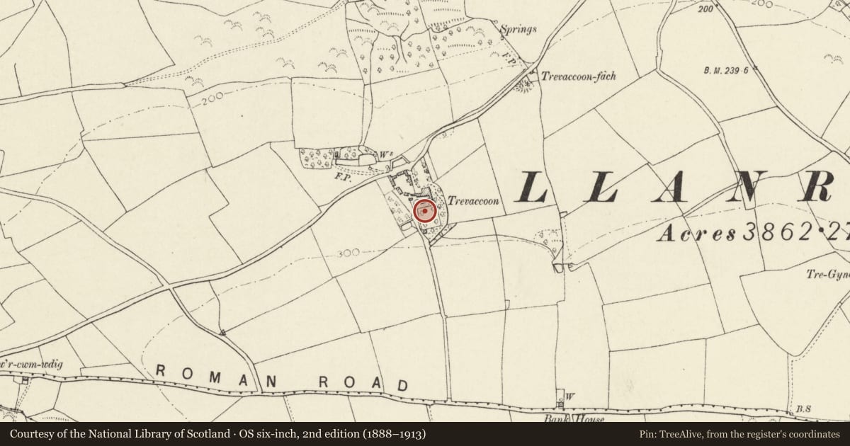
Slide toward Today to fade the historical sheet and see the modern map underneath.
David Rumsey Map Collection, Stanford LibrariesDavid Rumsey Map Collection, Stanford LibrariesDavid Rumsey Map Collection, Stanford LibrariesDavid Rumsey Map Collection, Stanford LibrariesDavid Rumsey Map Collection, Stanford Libraries
5 historical maps cover this location, the earliest the 1608 map "(13) Cambriae Typus." (David Rumsey Map Collection, Stanford Libraries).
Historical maps covering this location
- 1608 · (13) Cambriae Typus. (David Rumsey Map Collection, Stanford Libraries)
- 1636 · Cornubia : Devonia, Somersetus, Dorcestria, Wiltonia, Glocestria ... (David Rumsey Map Collection, Stanford Libraries)
- 1637 · Particular description of Wales. Cambria seu Wallia (David Rumsey Map Collection, Stanford Libraries)
- 1898 · 209 St David's (Hills) (David Rumsey Map Collection, Stanford Libraries)
- 1901 · Sheet 13. (David Rumsey Map Collection, Stanford Libraries)
Cadw's description
Location
Situated on hillside immediately behind Trevaccoon house, which is on southern side of the lane at St David’s from Llanrhian, about 700m SW of village crossroads.
Exterior
Early C19. High rubble stone walls enclosing sloping walled garden about 40m by 45m now partly infilled with C20 agricultural buildings. Larger later opening in west side. East side has original cambered head doorway with SH, for Samuel Harries, on plaque above. Attached at outside SW angle is a two storey rubble stone building, now gutted, possibly originally a formal garden building, unfinished or part demolished and converted to utilitarian structure. East wall formerly extended further S and has blocked remains of arched doorway and a ground floor window to right with voussoirs and keystone. Plain first floor window. South gable wall is plain, possibly rebuilt further N when the building was reduced, as west wall is longer and has traces of arched centre door and flanking windows (all blocked and voussoirs removed) matching those opposite. Plain blocked upper windows. North end has plain doorway to ground floor right and large flight of outside steps to upper door on right.
Condition: Poor
Reason for designation
Group value with Trevaccoon and other listed farm buildings.
Nearby in the register
- Walls to walled garden at TrevacoonDomesticunder 1 mi
- TrevacoonDomesticunder 1 mi
- Farm Building to W of TrevacoonAgriculture and Subsistenceunder 1 mi
- Outbuilding, former stable, on E.side of Farmyard at TrevacoonDomesticunder 1 mi
Other entries of the same register within about three miles of this one, by straight line.