Cof Cymru: National Historic Assets of Wales · Wales
Nos. 18 and 20 Hill Street
Haverfordwest, Pembrokeshire, Wales
A Grade II listed building in Haverfordwest, Pembrokeshire, designated on 1 July 1974.
The record
- Designation
- Listed building, Grade II
- Broad class
- Domestic
- Date of designation
- 1 July 1974
- Town
- Haverfordwest
- Community
- Haverfordwest
- Unitary authority
- Pembrokeshire
- Country
- Wales
- Coordinates
- 51.79921, -4.97124
- Cadw reference
- 12153
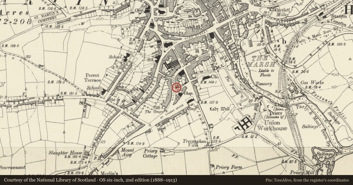
Slide toward Today to fade the historical sheet and see the modern map underneath.
David Rumsey Map Collection, Stanford LibrariesDavid Rumsey Map Collection, Stanford LibrariesDavid Rumsey Map Collection, Stanford LibrariesDavid Rumsey Map Collection, Stanford LibrariesDavid Rumsey Map Collection, Stanford Libraries
5 historical maps cover this location, the earliest the 1608 map "(13) Cambriae Typus." (David Rumsey Map Collection, Stanford Libraries).
Historical maps covering this location
- 1608 · (13) Cambriae Typus. (David Rumsey Map Collection, Stanford Libraries)
- 1636 · Cornubia : Devonia, Somersetus, Dorcestria, Wiltonia, Glocestria ... (David Rumsey Map Collection, Stanford Libraries)
- 1891 · Sheet 10. Ordnance Survey of England and Wales. . (David Rumsey Map Collection, Stanford Libraries)
- 1898 · 228 Haverfordwest (Hills) (David Rumsey Map Collection, Stanford Libraries)
- 1901 · Sheet 13. (David Rumsey Map Collection, Stanford Libraries)
Cadw's description
Location
Situated in terraced row, on corner of Rosemary Lane.
History
Pair of late Georgian town houses, now one and divided into flats. No 20 was occupied by W.H. Devereux in 1901, and by W.H. Reynolds JP, cabinet maker in 1926. Ground floors have been restored since 1974, an old photograph shows two C19 large windows to No 18 and no door to No 20.
Exterior
Pair of terraced houses, painted lined stucco with slate roof and flat eaves. Similar eaves line but steeper roof than No 16. Rendered left end stack, brick right end stack. Each house is of three storeys and three bays. Renewed horned sash windows, 9-pane to top floor, 12-pane elsewhere. Recessed centre doorway, with five new 6-panel doors with overlights. No 18 had in 1974
double entrance doors of 3 panels each with rectangular panel at top and bottom and circular panel in centre and a shop window to either side. No 20 had a 6-panel door with top 4 panels fielded and a modern door to left.
Interior
Interior not inspected, said to be all altered.
Reason for designation
Included for their special architectural interest as a pair of substantial Georgian town houses.
Nearby in the register
- Hillborough House and area railingsDomesticunder 1 mi
- Forecourt walls, railings and gates to the Albany ChurchReligious, Ritual and Funeraryunder 1 mi
- 29 Hill StreetDomesticunder 1 mi
- 14 Hill StreetDomesticunder 1 mi
Other entries of the same register within about three miles of this one, by straight line.