Cof Cymru: National Historic Assets of Wales · Wales
29 Hill Street
Haverfordwest, Pembrokeshire, Wales
A Grade II* listed building in Haverfordwest, Pembrokeshire, designated on 12 October 1951.
The record
- Designation
- Listed building, Grade II*
- Broad class
- Domestic
- Date of designation
- 12 October 1951
- Town
- Haverfordwest
- Community
- Haverfordwest
- Unitary authority
- Pembrokeshire
- Country
- Wales
- Coordinates
- 51.79936, -4.97159
- Cadw reference
- 12137
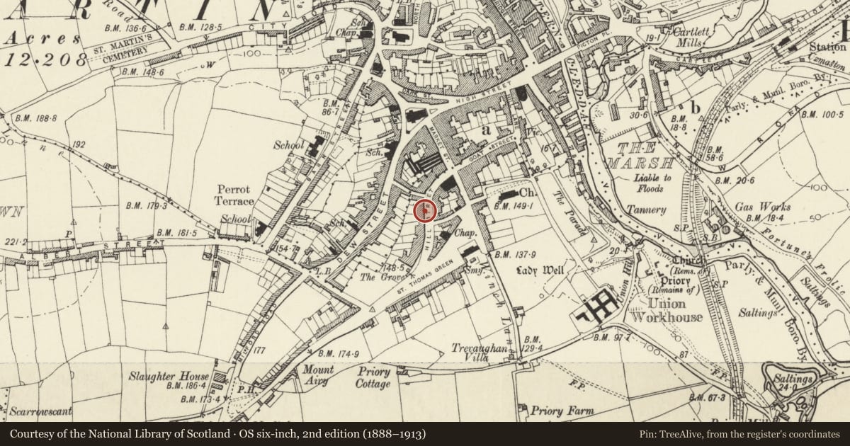
Slide toward Today to fade the historical sheet and see the modern map underneath.
David Rumsey Map Collection, Stanford LibrariesDavid Rumsey Map Collection, Stanford LibrariesDavid Rumsey Map Collection, Stanford LibrariesDavid Rumsey Map Collection, Stanford LibrariesDavid Rumsey Map Collection, Stanford Libraries
5 historical maps cover this location, the earliest the 1608 map "(13) Cambriae Typus." (David Rumsey Map Collection, Stanford Libraries).
Historical maps covering this location
- 1608 · (13) Cambriae Typus. (David Rumsey Map Collection, Stanford Libraries)
- 1636 · Cornubia : Devonia, Somersetus, Dorcestria, Wiltonia, Glocestria ... (David Rumsey Map Collection, Stanford Libraries)
- 1891 · Sheet 10. Ordnance Survey of England and Wales. . (David Rumsey Map Collection, Stanford Libraries)
- 1898 · 228 Haverfordwest (Hills) (David Rumsey Map Collection, Stanford Libraries)
- 1901 · Sheet 13. (David Rumsey Map Collection, Stanford Libraries)
Cadw's description
Location
Situated in terraced row against right end of C20 College Court development.
History
Later C18 town house, with some C19 external detail. Pane of glass with date 1765 said to be in rear wing. Occupied by Henry Mathias in 1884.
Exterior
Terraced house, painted roughcast with slate roof and C20 eaves board. Large square brick left end stack. Three storeys, three bays, with middle bay spaced slightly to the right. Hornless sash windows, square six-pane to top floor, 12-pane to first floor, and later horned plate glass sashes to ground floor. First and ground floor windows have raised lintels with keystones. Recessed centre 6-panel door in flush-panelled reveals, the top two door panels cut away and glazed. Timber C19 doorcase with pilasters, entablature and moulded cornice.
Wrought iron area railings with slender stepped finials, pointed at the ends.
Interior
Interior not inspected.
Reason for designation
Included for its special architectural interest as substantial late Georgian town house.
Nearby in the register
- Nos 25 and 27 Hill StreetCommercialunder 1 mi
- Hillborough House and area railingsDomesticunder 1 mi
- 14 Hill StreetDomesticunder 1 mi
- No 23 Hill Street and railingsDomesticunder 1 mi
Other entries of the same register within about three miles of this one, by straight line.