Cof Cymru: National Historic Assets of Wales · Wales
Summerville House
Haverfordwest, Pembrokeshire, Wales
A Grade II listed building in Haverfordwest, Pembrokeshire, designated on 1 July 1974.
The record
- Designation
- Listed building, Grade II
- Broad class
- Domestic
- Date of designation
- 1 July 1974
- Town
- Haverfordwest
- Community
- Haverfordwest
- Unitary authority
- Pembrokeshire
- Country
- Wales
- Coordinates
- 51.80164, -4.97190
- Cadw reference
- 12058
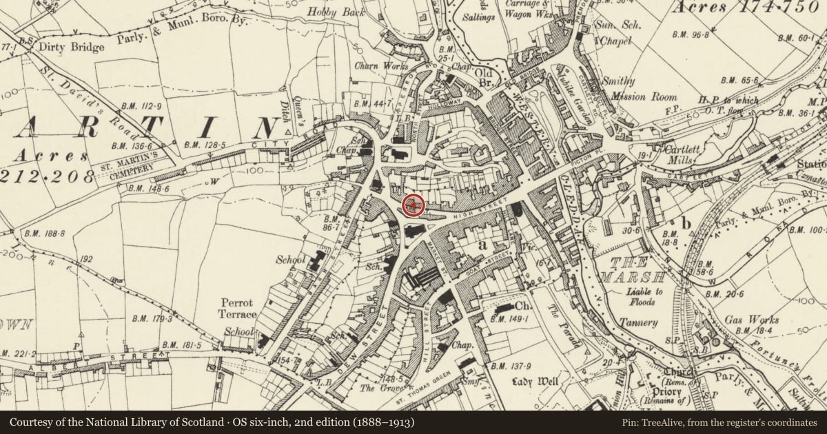
Slide toward Today to fade the historical sheet and see the modern map underneath.
David Rumsey Map Collection, Stanford LibrariesDavid Rumsey Map Collection, Stanford LibrariesDavid Rumsey Map Collection, Stanford LibrariesDavid Rumsey Map Collection, Stanford LibrariesDavid Rumsey Map Collection, Stanford Libraries
5 historical maps cover this location, the earliest the 1608 map "(13) Cambriae Typus." (David Rumsey Map Collection, Stanford Libraries).
Historical maps covering this location
- 1608 · (13) Cambriae Typus. (David Rumsey Map Collection, Stanford Libraries)
- 1636 · Cornubia : Devonia, Somersetus, Dorcestria, Wiltonia, Glocestria ... (David Rumsey Map Collection, Stanford Libraries)
- 1891 · Sheet 10. Ordnance Survey of England and Wales. . (David Rumsey Map Collection, Stanford Libraries)
- 1898 · 228 Haverfordwest (Hills) (David Rumsey Map Collection, Stanford Libraries)
- 1901 · Sheet 13. (David Rumsey Map Collection, Stanford Libraries)
Cadw's description
Location
Situated at end of terraced row Nos 7-14 Dark Street.
History
Terraced house with late Georgian style front, probably early to mid C19, probably of one build with No 8, though not uniform floor levels. Since 1974 the moulded wood eaves cornice and mask heads to guttering have gone, as also the panelled door.
Exterior
Terraced house, unpainted roughcast with close eaved slate roof and no end stack. Three storeys, one- window range. Small-paned sash windows: 9-pane sash to top floor, 12-pane sash to first floor, and to ground floor, centre and right. C20 door with overlight to left. Rubble stone right end wall with added lean-to along ground floor. Two windows with brick cambered heads each floor above, left one blocked, the right one with C20 metal glazing. Brickwork of chimney shaft in gable. Rear wing to right with stairlight with cambered brick head and window under eaves to right. Gable end has blocked loft window to right of centre, and first floor big timber oriel of 8-16-8 panes, the dividing piers with roundels at tops. Modern door up steps to ground floor left, and broad basement opening.
Interior
Interior not inspected.
Reason for designation
Included for group value with No 8 as two tall late Georgian terraced houses of special architectural interest.
Nearby in the register
- Somerset HouseDomesticunder 1 mi
- Nos 9 & 10 Dark StreetDomesticunder 1 mi
- Former Stables attached to No 6 Dark StreetNo class recordedunder 1 mi
- The Assembly RoomsRecreationalunder 1 mi
Other entries of the same register within about three miles of this one, by straight line.