Cof Cymru: National Historic Assets of Wales · Wales
Glandovan Lodge
Cilgerran, Pembrokeshire, Wales
A Grade II listed building in Glandovan, Cilgerran, Pembrokeshire, designated on 16 January 1952.
The record
- Designation
- Listed building, Grade II
- Broad class
- Domestic
- Date of designation
- 16 January 1952
- Locality
- Glandovan
- Community
- Cilgerran
- Unitary authority
- Pembrokeshire
- Country
- Wales
- Coordinates
- 52.04287, -4.63107
- Cadw reference
- 11975
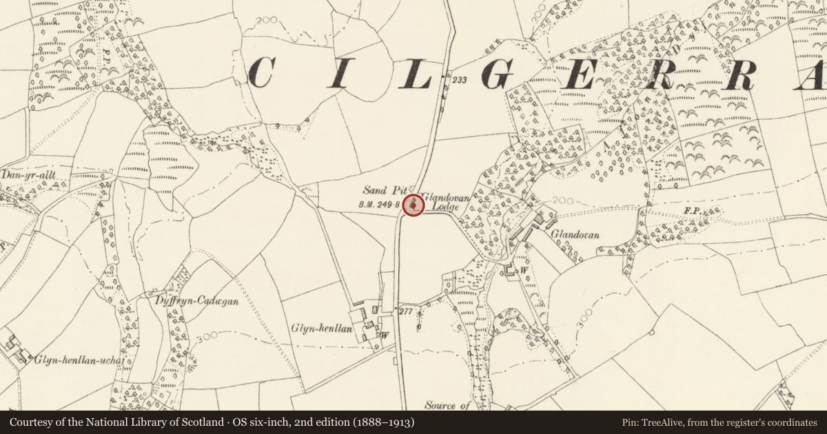
Slide toward Today to fade the historical sheet and see the modern map underneath.
David Rumsey Map Collection, Stanford LibrariesDavid Rumsey Map Collection, Stanford LibrariesDavid Rumsey Map Collection, Stanford LibrariesDavid Rumsey Map Collection, Stanford LibrariesDavid Rumsey Map Collection, Stanford Libraries
5 historical maps cover this location, the earliest the 1608 map "(13) Cambriae Typus." (David Rumsey Map Collection, Stanford Libraries).
Historical maps covering this location
- 1608 · (13) Cambriae Typus. (David Rumsey Map Collection, Stanford Libraries)
- 1830 · V.3:11-15:XV. Britisches Reich. A. Kon: England. b. Frstenthum Wales: Shire: 37-40 (David Rumsey Map Collection, Stanford Libraries)
- 1891 · Sheet 10. Ordnance Survey of England and Wales. . (David Rumsey Map Collection, Stanford Libraries)
- 1898 · 193 Cardigan (Hills) (David Rumsey Map Collection, Stanford Libraries)
- 1901 · Sheet 13. (David Rumsey Map Collection, Stanford Libraries)
Cadw's description
Location
Situated on the E side of the Cilgerran-Rhos Hill road, some 1.3km S of Cilgerran. The entrance lodge to Glandovan, owned by the Gower family from c.1700 to mid C20.
Exterior
Earlier C19 lodge to Glandovan, stucco with hipped slate roofs, bracketed eaves and two rendered stacks. Single-storey, square plan with three-bay fronts to the W and S, plain pointed openings with later C19 or C20 plate glass sashes and centre doors, blank on W front. S front has C20 door and overlight. Valley roofs with chimneys inset from W and E ridges.
Reason for designation
Group value with the gatepiers, gates and railings.
Nearby in the register
- Gatepiers, Gates and Railings at Glandovan LodgeDomesticunder 1 mi
- Outbuilding on N Side of Stable Court at GlandovanDomesticunder 1 mi
- Attached Wall with GatepiersDomesticunder 1 mi
- Outbuilding on S Side of stable court at GlandovanDomesticunder 1 mi
Other entries of the same register within about three miles of this one, by straight line.