Cof Cymru: National Historic Assets of Wales · Wales
Ivy Cottage, including Gates and Railings
Llanelli, Carmarthenshire, Wales
A Grade II listed building in Llanelli, Carmarthenshire, designated on 12 March 1992.
The record
- Designation
- Listed building, Grade II
- Broad class
- Domestic
- Date of designation
- 12 March 1992
- Community
- Llanelli
- Unitary authority
- Carmarthenshire
- Country
- Wales
- Coordinates
- 51.68658, -4.16262
- Cadw reference
- 11949
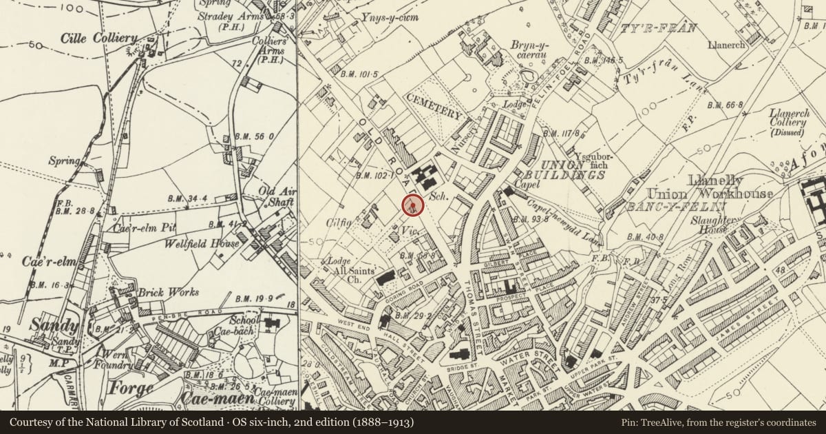
Slide toward Today to fade the historical sheet and see the modern map underneath.
David Rumsey Map Collection, Stanford LibrariesDavid Rumsey Map Collection, Stanford LibrariesNational Library of ScotlandDavid Rumsey Map Collection, Stanford LibrariesDavid Rumsey Map Collection, Stanford Libraries
5 historical maps cover this location, the earliest the 1636 map "Cornubia : Devonia, Somersetus, Dorcestria, Wiltonia, Glocestria ..." (David Rumsey Map Collection, Stanford Libraries).
Historical maps covering this location
- 1636 · Cornubia : Devonia, Somersetus, Dorcestria, Wiltonia, Glocestria ... (David Rumsey Map Collection, Stanford Libraries)
- 1637 · The fourth table of England. Cornub. Devonia, Somerset etc. (David Rumsey Map Collection, Stanford Libraries)
- 1891 · Sheet 10. Ordnance Survey of England and Wales. . (David Rumsey Map Collection, Stanford Libraries)
- 1920 · Sheet 100. Llanelly. (David Rumsey Map Collection, Stanford Libraries)
- 1963 · Map No. 4 - Local Government Commission for Wales : [Definitive maps showing proposed… (National Library of Scotland)
Cadw's description
Location
Slightly set back from street-line and attached to Cilfig Lodge on right some 50ám north of drive to the Vicarage.
Exterior
Circa 1840-50 house in stucco with concrete tiled roof and red brick end stacks. Two-storey 3-window range of 16-pane hornless sashes and centre 4-panel door with overlight and panelled reveals in painted timber corniced doorcase. Doorcase has panelled piers, console brackets and dentilled cornice, broken forward over brackets. Thin stone band between floors. Slate sills. Short single storey section to right with one small-paned window.
Ashlar gatepiers with concave pyramid caps and spearhead iron gate. C20 brick walls with spearhead railings each side.
House is not illustrated in circa 1840 watercolour of Cilfig Lodge.
Nearby in the register
- Cilfig LodgeDomesticunder 1 mi
- The VicarageDomesticunder 1 mi
- 17a Goring RoadDomesticunder 1 mi
- 17 Goring RoadDomesticunder 1 mi
Other entries of the same register within about three miles of this one, by straight line.