Cof Cymru: National Historic Assets of Wales · Wales
17 Goring Road
Llanelli, Carmarthenshire, Wales
A Grade II listed building in Llanelli, Carmarthenshire, designated on 30 November 1964.
The record
- Designation
- Listed building, Grade II
- Broad class
- Domestic
- Date of designation
- 30 November 1964
- Town
- Llanelli
- Community
- Llanelli
- Unitary authority
- Carmarthenshire
- Country
- Wales
- Coordinates
- 51.68543, -4.16171
- Cadw reference
- 11918
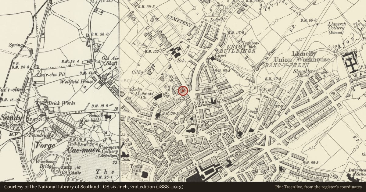
Slide toward Today to fade the historical sheet and see the modern map underneath.
David Rumsey Map Collection, Stanford LibrariesDavid Rumsey Map Collection, Stanford LibrariesNational Library of ScotlandDavid Rumsey Map Collection, Stanford LibrariesDavid Rumsey Map Collection, Stanford Libraries
5 historical maps cover this location, the earliest the 1636 map "Cornubia : Devonia, Somersetus, Dorcestria, Wiltonia, Glocestria ..." (David Rumsey Map Collection, Stanford Libraries).
Historical maps covering this location
- 1636 · Cornubia : Devonia, Somersetus, Dorcestria, Wiltonia, Glocestria ... (David Rumsey Map Collection, Stanford Libraries)
- 1637 · The fourth table of England. Cornub. Devonia, Somerset etc. (David Rumsey Map Collection, Stanford Libraries)
- 1891 · Sheet 10. Ordnance Survey of England and Wales. . (David Rumsey Map Collection, Stanford Libraries)
- 1920 · Sheet 100. Llanelly. (David Rumsey Map Collection, Stanford Libraries)
- 1963 · Map No. 4 - Local Government Commission for Wales : [Definitive maps showing proposed… (National Library of Scotland)
Cadw's description
Location
Situated in terraced row on street-line.
Exterior
Circa 1830-40, 2 houses in stucco with painted stone plinth and painted timber bracketed eaves cornice, concrete tiles and rebuilt brick stacks. No 17 is formal 3-window range, No 17a to left has matching one-window range and door to left. Sixteen-pane hornless sashes with painted stone sills. No 17 has 5-panel centre door with traceried overlight and panelled reveals. Large painted timber Doric doorcase with fluted Roman Doric columns and cornice entablature with triglyphs, paterae and mutules.
One dormer to left.
No 17a has doorway to left, similar 5-panel door but no overlight and, therefore, smaller doorcase with fluted Roman Doric pilasters, similar frieze but damaged cornice.
Nos 15, 17 and 17a appear of similar date, with No 13 as a later matching extension, and No 19 possibly of slightly earlier date.
Reason for designation
Group value.
Nearby in the register
- 17a Goring RoadDomesticunder 1 mi
- 19 Goring RoadDomesticunder 1 mi
- 15 Goring RoadDomesticunder 1 mi
- 13 Goring Road including forecourt gate and railingsDomesticunder 1 mi
Other entries of the same register within about three miles of this one, by straight line.