Cof Cymru: National Historic Assets of Wales · Wales
The Masons Arms
Kidwelly, Carmarthenshire, Wales
A Grade II listed building in Kidwelly/Cydweli, Kidwelly, Carmarthenshire, designated on 7 November 1980.
The record
- Designation
- Listed building, Grade II
- Broad class
- Commercial
- Date of designation
- 7 November 1980
- Locality
- Kidwelly/Cydweli
- Town
- Kidwelly
- Community
- Kidwelly
- Unitary authority
- Carmarthenshire
- Country
- Wales
- Coordinates
- 51.74095, -4.30695
- Cadw reference
- 11882
Slide toward Today to fade the historical sheet and see the modern map underneath.
David Rumsey Map Collection, Stanford LibrariesDavid Rumsey Map Collection, Stanford LibrariesDavid Rumsey Map Collection, Stanford LibrariesDavid Rumsey Map Collection, Stanford LibrariesDavid Rumsey Map Collection, Stanford Libraries
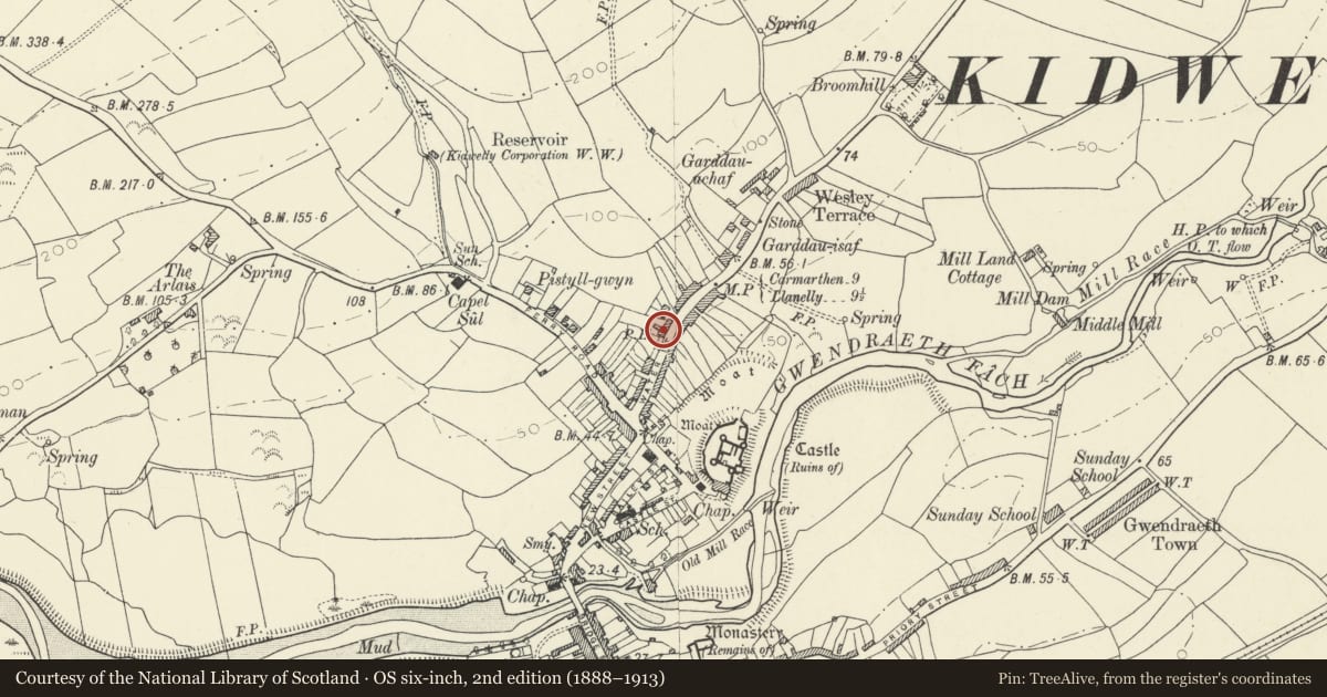
5 historical maps cover this location, the earliest the 1636 map "Cornubia : Devonia, Somersetus, Dorcestria, Wiltonia, Glocestria ..." (David Rumsey Map Collection, Stanford Libraries).
Historical maps covering this location
- 1636 · Cornubia : Devonia, Somersetus, Dorcestria, Wiltonia, Glocestria ... (David Rumsey Map Collection, Stanford Libraries)
- 1637 · The fourth table of England. Cornub. Devonia, Somerset etc. (David Rumsey Map Collection, Stanford Libraries)
- 1891 · Sheet 10. Ordnance Survey of England and Wales. . (David Rumsey Map Collection, Stanford Libraries)
- 1898 · 229 Carmarthen (Hills) (David Rumsey Map Collection, Stanford Libraries)
- 1920 · Sheet 100. Llanelly. (David Rumsey Map Collection, Stanford Libraries)
Cadw's description
Location
Situated on W side of main road (A 484) N of centre of Kidwelly, in terraced row, some 120m N of Ferry Road junction.
History
C18 public house, possibly including earlier core. One of the last thatched roofs of S.W. Wales to have been consistently maintained. Old photographs show that the terraced row was continuous, the house to S demolished in C20.
Exterior
Roughcast with thatched roof and end stacks, brick to left, rendered to right. Two storeys, the upper windows under eaves with thatch eyebrows over. Three-window range, door between second and third windows. Windows openings are narrow, C20 glazing to upper windows, ground floor hornless 12-pane sash to left, horned 4-pane sashes to centre and right. 4-panel door.
S end wall rebuilt in modern brick when adjoining house was demolished. Rear obscured by C20 full-length lean-to.
Interior
Ground floor wholly altered. Projecting chimneybreast at N end.
Reason for designation
Listed as an early C18 public house with one of the last consistently-maintained thatched roof in the region.
Nearby in the register
- Castell Cydweli / Kidwelly CastleCastleunder 1 mi
- Kidwelly Medieval Town (Part of)Townunder 1 mi
- Kidwelly CastleDefenceunder 1 mi
- The Old Moat HouseDomesticunder 1 mi
Other entries of the same register within about three miles of this one, by straight line.