Cof Cymru: National Historic Assets of Wales · Wales
Circular latrine at Blaen-nant-yr-hebog
Glynneath, Neath Port Talbot, Wales
A Grade II listed building in Neath, Glynneath, Neath Port Talbot, designated on 24 October 1989.
The record
- Designation
- Listed building, Grade II
- Broad class
- Domestic
- Date of designation
- 24 October 1989
- Town
- Neath
- Community
- Glynneath
- Unitary authority
- Neath Port Talbot
- Country
- Wales
- Coordinates
- 51.72786, -3.69967
- Cadw reference
- 11851
Slide toward Today to fade the historical sheet and see the modern map underneath.
David Rumsey Map Collection, Stanford LibrariesDavid Rumsey Map Collection, Stanford LibrariesDavid Rumsey Map Collection, Stanford LibrariesDavid Rumsey Map Collection, Stanford LibrariesDavid Rumsey Map Collection, Stanford Libraries
5 historical maps cover this location, the earliest the 1636 map "Cornubia : Devonia, Somersetus, Dorcestria, Wiltonia, Glocestria ..." (David Rumsey Map Collection, Stanford Libraries).
Historical maps covering this location
- 1636 · Cornubia : Devonia, Somersetus, Dorcestria, Wiltonia, Glocestria ... (David Rumsey Map Collection, Stanford Libraries)
- 1637 · The fourth table of England. Cornub. Devonia, Somerset etc. (David Rumsey Map Collection, Stanford Libraries)
- 1830 · V.3:11-15:XV. Britisches Reich. A. Kon: England. b. Frstenthum Wales: Shire: 37-40 (David Rumsey Map Collection, Stanford Libraries)
- 1865 · England and Wales. England No. 6. (David Rumsey Map Collection, Stanford Libraries)
- 1898 · 231 Merthyr Tydfil (Hills) (David Rumsey Map Collection, Stanford Libraries)
Cadw's description
Location
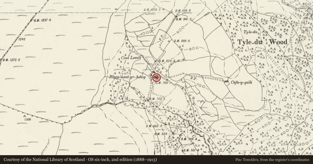
Reached along several miles of Forestry Commission tracks NW of the main Neath Valley Road (A465). In Crugau wood, high above the Forestry Commission office. Situated amongst trees a short distance W of the ruin of Blaen Nant-yr-Hebog house.
History
Early C19 latrine built in the style of circular pigsties.
Exterior
Site was impenetrable at time of resurvey (September 2003). The doorway lintel was broken and corbelled roof in deteriorating condition in July 1989. The following is the original description.
Early C19 latrine built in the style of circular pigsties with corbelled stone slab roof. The internal area is ovoid shape and contains a stone slab formerly supporting the seat. Drainage was by means of a narrow stream through two openings.
Reason for designation
Listed as an example of the ancient technique of corbelling, normally associated with circular pigsties, but here found in the only currently known example of a circular latrine.
Nearby in the register
- CrugauDomesticunder 1 mi
- Barn at CrugauAgriculture and Subsistenceunder 1 mi
- Rheola HouseDomesticunder 1 mi
- Milestone on B4242 near CrugauTransportunder 1 mi
Other entries of the same register within about three miles of this one, by straight line.