Cof Cymru: National Historic Assets of Wales · Wales
Friends Meeting House
Neath, Neath Port Talbot, Wales
A Grade II listed building in Neath, Neath Port Talbot, designated on 26 November 1986.
The record
- Designation
- Listed building, Grade II
- Broad class
- Religious, Ritual and Funerary
- Date of designation
- 26 November 1986
- Community
- Neath
- Unitary authority
- Neath Port Talbot
- Country
- Wales
- Coordinates
- 51.66527, -3.80363
- Cadw reference
- 11788
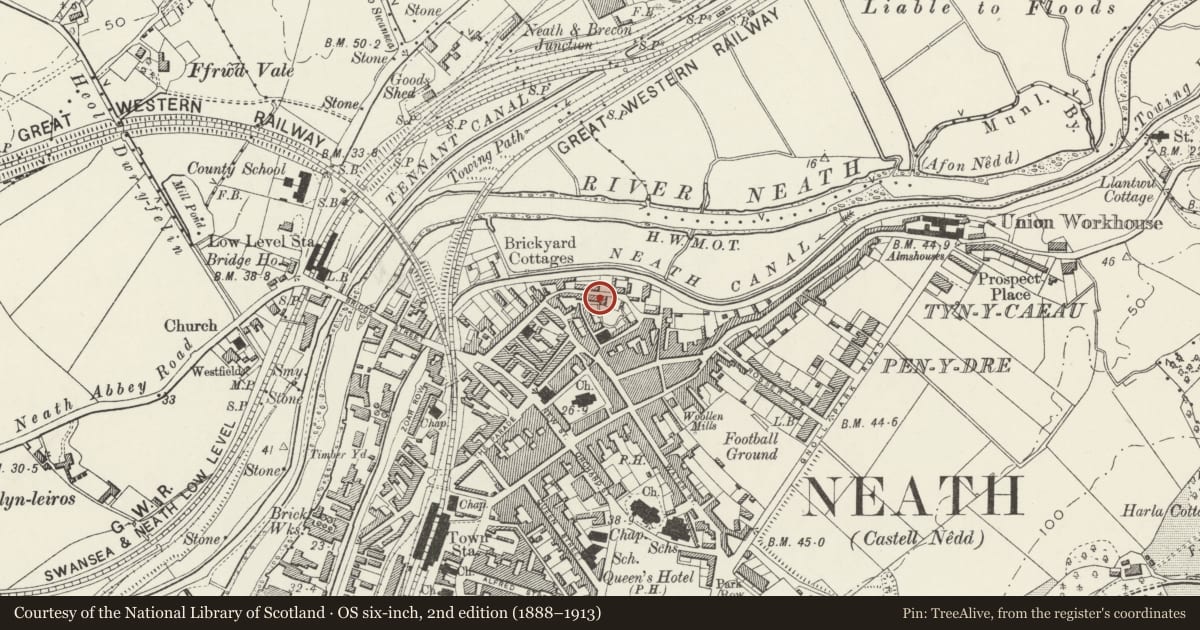
Slide toward Today to fade the historical sheet and see the modern map underneath.
David Rumsey Map Collection, Stanford LibrariesDavid Rumsey Map Collection, Stanford LibrariesDavid Rumsey Map Collection, Stanford LibrariesDavid Rumsey Map Collection, Stanford LibrariesDavid Rumsey Map Collection, Stanford Libraries
5 historical maps cover this location, the earliest the 1636 map "Cornubia : Devonia, Somersetus, Dorcestria, Wiltonia, Glocestria ..." (David Rumsey Map Collection, Stanford Libraries).
Historical maps covering this location
- 1636 · Cornubia : Devonia, Somersetus, Dorcestria, Wiltonia, Glocestria ... (David Rumsey Map Collection, Stanford Libraries)
- 1637 · The fourth table of England. Cornub. Devonia, Somerset etc. (David Rumsey Map Collection, Stanford Libraries)
- 1865 · England and Wales. England No. 6. (David Rumsey Map Collection, Stanford Libraries)
- 1891 · Sheet 10. Ordnance Survey of England and Wales. . (David Rumsey Map Collection, Stanford Libraries)
- 1897 · 247 Swansea (Hills) (David Rumsey Map Collection, Stanford Libraries)
Cadw's description
Location
Situated to the N of the Castle gatehouse at right angles to the road; graveyard to the left.
History
C1792.
Exterior
Rectangular late Georgian meeting house. Rubble Masonry with quoins and brick window dressings; hipped slate roof. Three-window E front with sash windows, one small-pane, to meeting room; lower flat roofed entrance lobby advanced to left with later alterations, small-pane fixed glazed window and raised scribed panelled door with brick lintel in the return angel. Short small-pane sash window above to upper meeting room. Low panelled basement door with brick surround to right beside gated arched entrance with roughly dressed pedimented architrave set into high rubble and iron railed boundary wall to sloping graveyard. The wall adjoins the plain, roadside end wall of the meeting house, with date plaque and curves around to the E incorporating the N boundary of the Castle inner ward. Rear (W) side is part cement rendered, rubble exposed where gable end of a row of cottages formerly adjoined; horned sash window to upper meeting room.
Graveyard overgrown an the Meeting House rarely used at time of inspection.
Interior
Plain interior comprising tall square main meeting room to right with 2 tier dais to end wall and full height boarded and panelled screen to entrance end with doors through to narrow cross passage. Smaller upper meeting room.
Reason for designation
A rare example of a Quaker Meeting House in Wales. Group value with Neath Castle adjoining.
The graveyard lies within a Scheduled Ancient Monument site.
Nearby in the register
- Neath CastleCastleunder 1 mi
- Neath CastleDefenceunder 1 mi
- Moose HallReligious, Ritual and Funeraryunder 1 mi
- 7a Old Market StreetCommercialunder 1 mi
Other entries of the same register within about three miles of this one, by straight line.