Cof Cymru: National Historic Assets of Wales · Wales
Moose Hall
Neath, Neath Port Talbot, Wales
A Grade II listed building in Neath, Neath Port Talbot, designated on 5 January 1989.
The record
- Designation
- Listed building, Grade II
- Broad class
- Religious, Ritual and Funerary
- Date of designation
- 5 January 1989
- Community
- Neath
- Unitary authority
- Neath Port Talbot
- Country
- Wales
- Coordinates
- 51.66480, -3.80361
- Cadw reference
- 11774
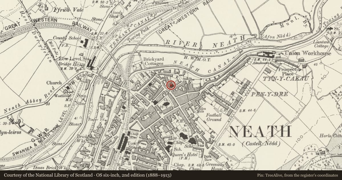
Slide toward Today to fade the historical sheet and see the modern map underneath.
David Rumsey Map Collection, Stanford LibrariesDavid Rumsey Map Collection, Stanford LibrariesDavid Rumsey Map Collection, Stanford LibrariesDavid Rumsey Map Collection, Stanford LibrariesDavid Rumsey Map Collection, Stanford Libraries
5 historical maps cover this location, the earliest the 1636 map "Cornubia : Devonia, Somersetus, Dorcestria, Wiltonia, Glocestria ..." (David Rumsey Map Collection, Stanford Libraries).
Historical maps covering this location
- 1636 · Cornubia : Devonia, Somersetus, Dorcestria, Wiltonia, Glocestria ... (David Rumsey Map Collection, Stanford Libraries)
- 1637 · The fourth table of England. Cornub. Devonia, Somerset etc. (David Rumsey Map Collection, Stanford Libraries)
- 1865 · England and Wales. England No. 6. (David Rumsey Map Collection, Stanford Libraries)
- 1891 · Sheet 10. Ordnance Survey of England and Wales. . (David Rumsey Map Collection, Stanford Libraries)
- 1897 · 247 Swansea (Hills) (David Rumsey Map Collection, Stanford Libraries)
Cadw's description
Location
On the street-line adjoining the castle opposite the junction with Old Market Street.
Exterior
C1813. The first Methodist Chapel in Neath. Two storey, 4 bay front. Squared rubble laid to narrow courses, plinth, limestone dressings. Stressed regular quoins. Moderately pitched slate roof, modern bargeboards, plain eaves. First floor bays recessed between pilasters with stressed quoins, doubled to extreme left and right. Plain stonework under eaves. Dressed stone architraves to round arched windows, blind tympani, .small paned 2 light casement windows. Continuous sill band.
Similar architraves to ground floor, windows blocked. Painted-on glazing bars. Similar round arched doorway to extreme right. Blind fanlight, modern door. End elevations pebble-dashed. Round arched window to left and wall at first floor level. Modern doorway to ground floor. Rectangular window to ground floor right end elevation, partially blocked; small paned casement window. Later Chapel adjoins to rear. Pebbledashed elevations; hipped slate roof, partly blocked deep round arched window.
Nearby in the register
- Neath CastleDefenceunder 1 mi
- Neath CastleCastleunder 1 mi
- 7a Old Market StreetCommercialunder 1 mi
- 7 Market StreetCommercialunder 1 mi
Other entries of the same register within about three miles of this one, by straight line.