Cof Cymru: National Historic Assets of Wales · Wales
Church of St Luke
Cwmbwrla, Swansea, Wales
A Grade II listed building in Cwmbwrla, Swansea, designated on 30 March 1987.
The record
- Designation
- Listed building, Grade II
- Broad class
- Religious, Ritual and Funerary
- Date of designation
- 30 March 1987
- Community
- Cwmbwrla
- Unitary authority
- Swansea
- Country
- Wales
- Coordinates
- 51.63634, -3.95411
- Cadw reference
- 11682
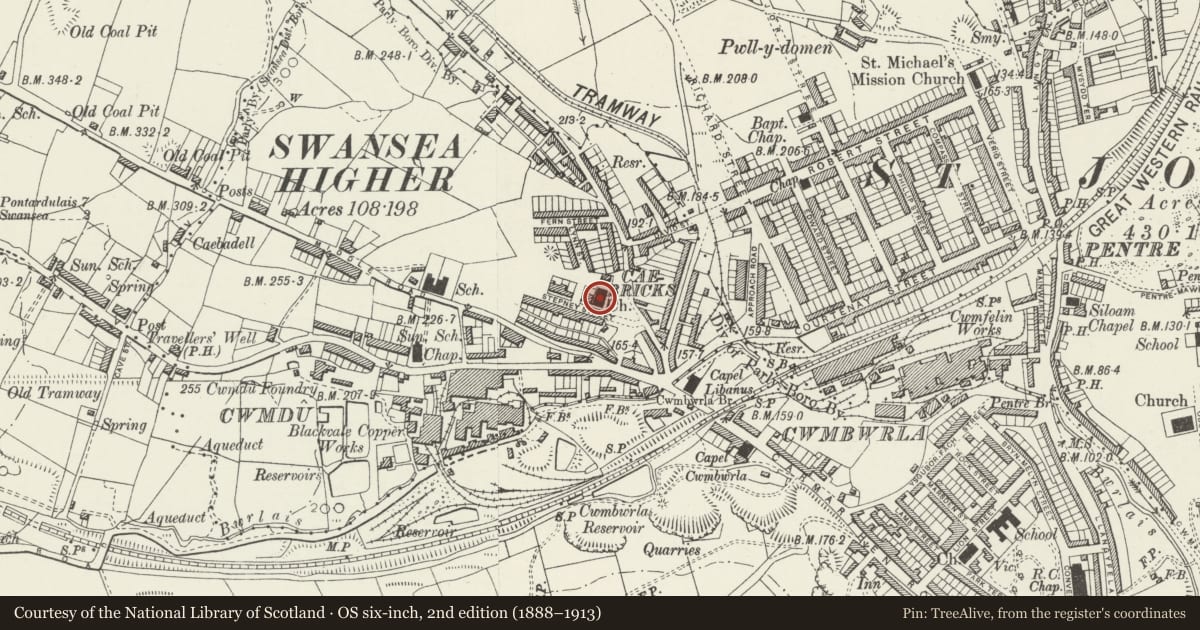
Slide toward Today to fade the historical sheet and see the modern map underneath.
David Rumsey Map Collection, Stanford LibrariesDavid Rumsey Map Collection, Stanford LibrariesDavid Rumsey Map Collection, Stanford LibrariesDavid Rumsey Map Collection, Stanford LibrariesDavid Rumsey Map Collection, Stanford Libraries
5 historical maps cover this location, the earliest the 1636 map "Cornubia : Devonia, Somersetus, Dorcestria, Wiltonia, Glocestria ..." (David Rumsey Map Collection, Stanford Libraries).
Historical maps covering this location
- 1636 · Cornubia : Devonia, Somersetus, Dorcestria, Wiltonia, Glocestria ... (David Rumsey Map Collection, Stanford Libraries)
- 1637 · The fourth table of England. Cornub. Devonia, Somerset etc. (David Rumsey Map Collection, Stanford Libraries)
- 1865 · England and Wales. England No. 6. (David Rumsey Map Collection, Stanford Libraries)
- 1891 · Sheet 10. Ordnance Survey of England and Wales. . (David Rumsey Map Collection, Stanford Libraries)
- 1897 · 247 Swansea (Hills) (David Rumsey Map Collection, Stanford Libraries)
Cadw's description
Location
Set on a terraced site across the slope, and looking down to A483 roundabout at Libanus Chapel.
History
Dated 1889. By E Bruce Vaughan, architect of Cardiff. Plain C13 Gothic.
Exterior
Plan; chancel flanked by S vestry and N organ chamber, aisled nave with transverse gables to aisles, SW tower-porch with spire.
Snecked rubble facings, freestone dressings, slate roofs, parapetted gables, stepped buttresses. W front with crucifix finial, triple cemented vents over wide 4-light Geometric window; projecting doorway under cill band with single order pointed arch flanked by lancets, boarded doors. Pair of lancets to end of left aisle. Polygonal stair-tower to lower stages f tower with twin lancet bell-openings and nook shafts, plain parapet and pyramidal spire with weathervane. Porch opening to side. Aisles with plate tracery under hoodmoulds, 3 light traceried chancel window. Railed forecourt above road.
Prominent landmark on hillside at Cwmdu.
Interior
Simple hall church interior with 4-bay nave, round piers to arcades, lower arches at W end. Open trussed nave roof with stone corbels, boarded waggon roofs to chancel and to transveres aisle bays. Chancel arch with twin shafts to corbels.
Nearby in the register
- Manselton School Attached BlockEducationunder 1 mi
- Manselton SchoolEducationunder 1 mi
- Mount Calvary English Baptist Chapel HallReligious, Ritual and Funeraryunder 1 mi
- Mount Calvary English Baptist ChapelReligious, Ritual and Funeraryunder 1 mi
Other entries of the same register within about three miles of this one, by straight line.