Cof Cymru: National Historic Assets of Wales · Wales
Mount Calvary English Baptist Chapel Hall
Cwmbwrla, Swansea, Wales
A Grade II listed building in Cwmbwrla, Swansea, designated on 30 March 1987.
The record
- Designation
- Listed building, Grade II
- Broad class
- Religious, Ritual and Funerary
- Date of designation
- 30 March 1987
- Community
- Cwmbwrla
- Unitary authority
- Swansea
- Country
- Wales
- Coordinates
- 51.63968, -3.95101
- Cadw reference
- 11678
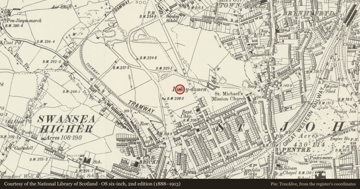
Slide toward Today to fade the historical sheet and see the modern map underneath.
David Rumsey Map Collection, Stanford LibrariesDavid Rumsey Map Collection, Stanford LibrariesDavid Rumsey Map Collection, Stanford LibrariesDavid Rumsey Map Collection, Stanford LibrariesDavid Rumsey Map Collection, Stanford Libraries
5 historical maps cover this location, the earliest the 1636 map "Cornubia : Devonia, Somersetus, Dorcestria, Wiltonia, Glocestria ..." (David Rumsey Map Collection, Stanford Libraries).
Historical maps covering this location
- 1636 · Cornubia : Devonia, Somersetus, Dorcestria, Wiltonia, Glocestria ... (David Rumsey Map Collection, Stanford Libraries)
- 1637 · The fourth table of England. Cornub. Devonia, Somerset etc. (David Rumsey Map Collection, Stanford Libraries)
- 1865 · England and Wales. England No. 6. (David Rumsey Map Collection, Stanford Libraries)
- 1891 · Sheet 10. Ordnance Survey of England and Wales. . (David Rumsey Map Collection, Stanford Libraries)
- 1897 · 247 Swansea (Hills) (David Rumsey Map Collection, Stanford Libraries)
Cadw's description
Location
On a corner site with main front facing N on to Elgin Street.
History
Ca 1909. Influence of W Beddoe Rees. Art Nouveau/late Gothic style.
Exterior
Snecked facings, pale freestone dressings (some red brick) slate roofs with tiled cresting. Gable flanked by poloygonal turrets with apsed staircase towers. Traceried 5-light window, band of blind panels over moulded arched doorway, chequered turrets with ball finials. Distinctive cusped panels and lights to crenellated top storey of stairs, buttressed side elevation with cross gable; 2 light cusped windows as before. Similar treatment to school-room gable with 3-light plain window over arched doorway, outside stairs to right. Piers and railing to forecourt.
Interior
Interior of chapel has intruded angles for open-handrail stairs. 3-sided ceiled roof with "crossing" bay over pulpit area, collar-beam trusses with arched braces resting on curved corbels. U-plan gallery with bowed, ironwork authemion panels, cast-iron columns; swept down gallery front below organ in arched chamber; perpendicular pulpit and open work handrails. Rear school-room with 3-sided ceiling roof, trusses on wall-posts, cast-iron columns behind panelled screens (one side only).
Nearby in the register
- Mount Calvary English Baptist ChapelReligious, Ritual and Funeraryunder 1 mi
- Manselton SchoolEducationunder 1 mi
- Manselton School Attached BlockEducationunder 1 mi
- Church of St Michael & all Angels (Manselton Parish Church)Religious, Ritual and Funeraryunder 1 mi
Other entries of the same register within about three miles of this one, by straight line.