Cof Cymru: National Historic Assets of Wales · Wales
Church of St Michael & all Angels (Manselton Parish Church)
Cwmbwrla, Swansea, Wales
A Grade II listed building in Cwmbwrla, Swansea, designated on 30 March 1987.
The record
- Designation
- Listed building, Grade II
- Broad class
- Religious, Ritual and Funerary
- Date of designation
- 30 March 1987
- Community
- Cwmbwrla
- Unitary authority
- Swansea
- Country
- Wales
- Coordinates
- 51.63965, -3.94961
- Cadw reference
- 11679
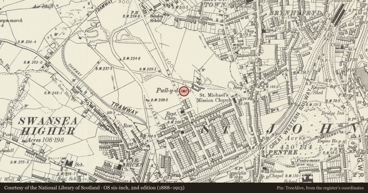
Slide toward Today to fade the historical sheet and see the modern map underneath.
David Rumsey Map Collection, Stanford LibrariesDavid Rumsey Map Collection, Stanford LibrariesDavid Rumsey Map Collection, Stanford LibrariesDavid Rumsey Map Collection, Stanford LibrariesDavid Rumsey Map Collection, Stanford Libraries
5 historical maps cover this location, the earliest the 1636 map "Cornubia : Devonia, Somersetus, Dorcestria, Wiltonia, Glocestria ..." (David Rumsey Map Collection, Stanford Libraries).
Historical maps covering this location
- 1636 · Cornubia : Devonia, Somersetus, Dorcestria, Wiltonia, Glocestria ... (David Rumsey Map Collection, Stanford Libraries)
- 1637 · The fourth table of England. Cornub. Devonia, Somerset etc. (David Rumsey Map Collection, Stanford Libraries)
- 1865 · England and Wales. England No. 6. (David Rumsey Map Collection, Stanford Libraries)
- 1891 · Sheet 10. Ordnance Survey of England and Wales. . (David Rumsey Map Collection, Stanford Libraries)
- 1897 · 247 Swansea (Hills) (David Rumsey Map Collection, Stanford Libraries)
Cadw's description
Location
On the corner with Bohun Street, ground falls steeply to E.
History
1904-5. Designed by E Bruce Vaughan of Cardiff. Cost about £6,000 (£4,000 donated by Mr R Glyn Vivian).
Exterior
Plain of undivided nave and chancel with vestries under, S aisle (N aisle never built), organ chamber and S porch. Perpendicular Gothic.
Twin gabled front to Manor Road, coursed rubble facings, Bath stone dressings, slate roofs with tiled crestings. Gable parapets with twin bellcote and weathervane to left over 5-light traceried window; 3 light window to S. Plinth and hoodmouldings. Buttressed side elevations, 2-light windows, cross-gable with 3 light window at E end (organ chamber). High E end with 5-light window, polygonal stair-tower in angle.
Interior
Simple interior has 5-bay arcade with polygonal piers, blocked N arch matching organ chamber arch to S. Ribbed and boarded ceilings with paired angle corbels at chancel entrance. Sedilia with foliage spandrels and paterae to hoodmould. Plain whitewashed walls with rere-arches to window splays, 2-bay arcade facing S aisle. Wooden lectern and pulpit.
Nearby in the register
- Manselton SchoolEducationunder 1 mi
- Mount Calvary English Baptist Chapel HallReligious, Ritual and Funeraryunder 1 mi
- Manselton School Attached BlockEducationunder 1 mi
- Mount Calvary English Baptist ChapelReligious, Ritual and Funeraryunder 1 mi
Other entries of the same register within about three miles of this one, by straight line.