Cof Cymru: National Historic Assets of Wales · Wales
Former GWR Revetment Walls along N side of South Dock
Waterfront / Y Glannau, Swansea, Wales
A Grade II listed building in Swansea, Waterfront / Y Glannau, designated on 30 March 1987.
The record
- Designation
- Listed building, Grade II
- Broad class
- Maritime
- Date of designation
- 30 March 1987
- Locality
- Swansea
- Community
- Waterfront / Y Glannau
- Unitary authority
- Swansea
- Country
- Wales
- Coordinates
- 51.61579, -3.94184
- Cadw reference
- 11652
Slide toward Today to fade the historical sheet and see the modern map underneath.
David Rumsey Map Collection, Stanford LibrariesDavid Rumsey Map Collection, Stanford LibrariesDavid Rumsey Map Collection, Stanford LibrariesDavid Rumsey Map Collection, Stanford LibrariesDavid Rumsey Map Collection, Stanford Libraries
5 historical maps cover this location, the earliest the 1636 map "Cornubia : Devonia, Somersetus, Dorcestria, Wiltonia, Glocestria ..." (David Rumsey Map Collection, Stanford Libraries).
Historical maps covering this location
- 1636 · Cornubia : Devonia, Somersetus, Dorcestria, Wiltonia, Glocestria ... (David Rumsey Map Collection, Stanford Libraries)
- 1637 · The fourth table of England. Cornub. Devonia, Somerset etc. (David Rumsey Map Collection, Stanford Libraries)
- 1865 · England and Wales. England No. 6. (David Rumsey Map Collection, Stanford Libraries)
- 1891 · Sheet 10. Ordnance Survey of England and Wales. . (David Rumsey Map Collection, Stanford Libraries)
- 1897 · 247 Swansea (Hills) (David Rumsey Map Collection, Stanford Libraries)
Cadw's description
Location
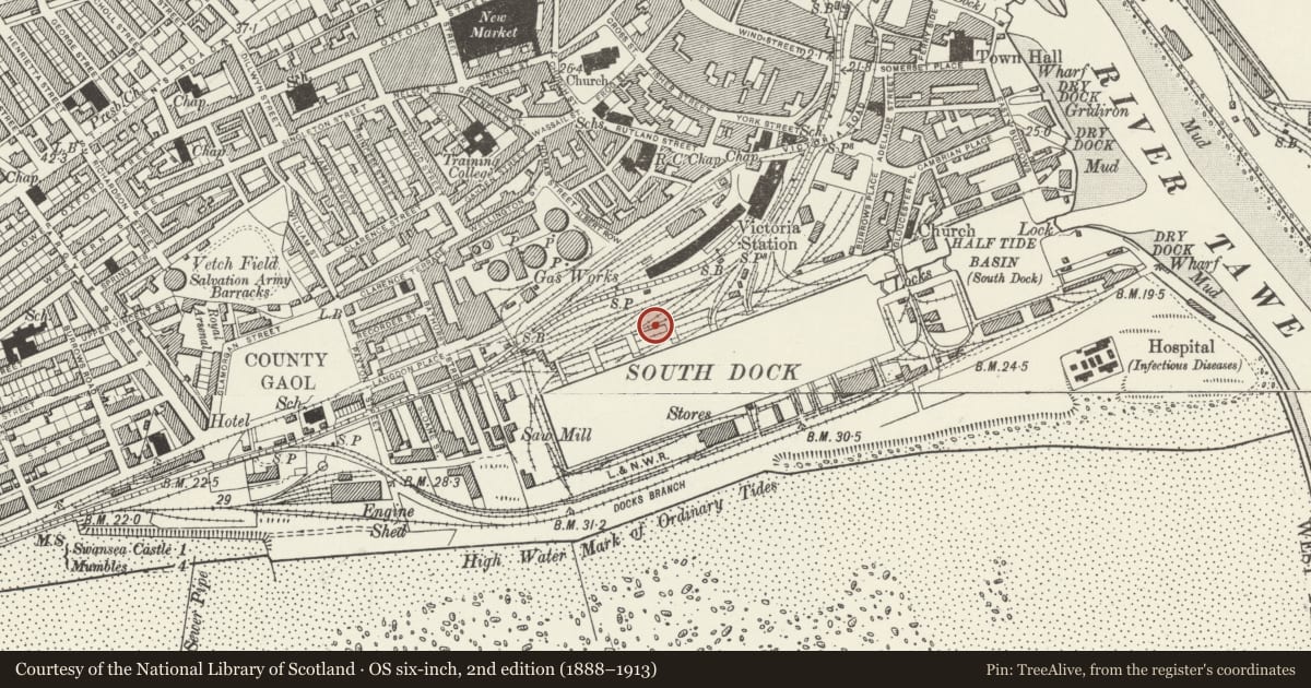
Running from W of Maritime Museum and to rear of modern housing on N quayside.
History
Between ca1859 (when S Dock opened) and 1876-7. S Dock line was originally built by Harbour Trustees and leased to South Wales Railway in 1862 and absorbed by Great Western Railway in 1865.
Exterior
Long section of snecked rubble revetment wall with six multi-arched bastions at irregular intervals (formerly the abutments for elevated rail decks to coaling towers at dock edge). Ramped treatment to plain sections. Plain parapets (partly rebuilt) above band course, voussoir treatment to arch rings, ramped fields. E end of wall is splayed back to NE with external stair (modern concrete treads and metal handrail) and ends on grassy embankment immediately S of Leisure Centre. (Arched elevated track way formerly ran on past Victoria Station.) Occasional arched pedestrian ways run through arches under former railway embankment; wide parabolic arch towards W end where wall steps back from angled bastion with single arch and continues briefly at set-back line.
Reason for designation
Group value.
Nearby in the register
- Presbytery at Catholic Church of St DavidReligious, Ritual and Funeraryunder 1 mi
- Maritime & Industrial MuseumRecreationalunder 1 mi
- St. David's Priory Catholic ChurchReligious, Ritual and Funeraryunder 1 mi
- York Place Baptist Chapel HallReligious, Ritual and Funeraryunder 1 mi
Other entries of the same register within about three miles of this one, by straight line.