Cof Cymru: National Historic Assets of Wales · Wales
Presbytery at Catholic Church of St David
Castle, Swansea, Wales
A Grade II listed building in Castle, Swansea, designated on 30 March 1987.
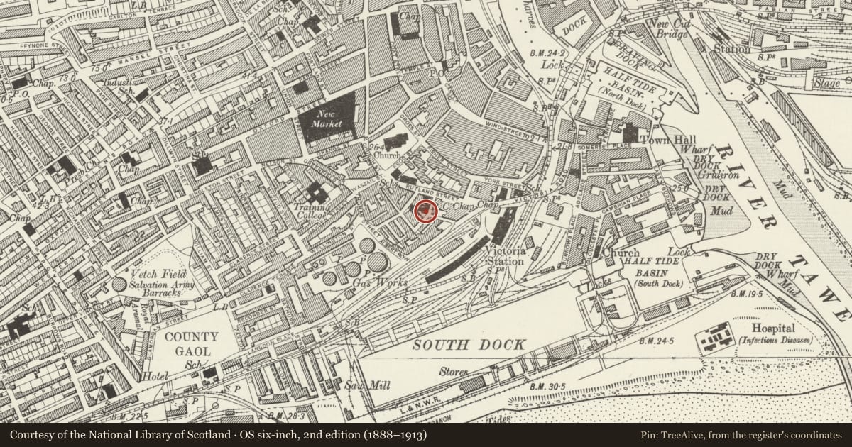
The record
- Designation
- Listed building, Grade II
- Broad class
- Religious, Ritual and Funerary
- Date of designation
- 30 March 1987
- Community
- Castle
- Unitary authority
- Swansea
- Country
- Wales
- Coordinates
- 51.61773, -3.94202
- Cadw reference
- 11616
Slide toward Today to fade the historical sheet and see the modern map underneath.
David Rumsey Map Collection, Stanford LibrariesDavid Rumsey Map Collection, Stanford LibrariesDavid Rumsey Map Collection, Stanford LibrariesDavid Rumsey Map Collection, Stanford LibrariesDavid Rumsey Map Collection, Stanford Libraries
5 historical maps cover this location, the earliest the 1636 map "Cornubia : Devonia, Somersetus, Dorcestria, Wiltonia, Glocestria ..." (David Rumsey Map Collection, Stanford Libraries).
Historical maps covering this location
- 1636 · Cornubia : Devonia, Somersetus, Dorcestria, Wiltonia, Glocestria ... (David Rumsey Map Collection, Stanford Libraries)
- 1637 · The fourth table of England. Cornub. Devonia, Somerset etc. (David Rumsey Map Collection, Stanford Libraries)
- 1865 · England and Wales. England No. 6. (David Rumsey Map Collection, Stanford Libraries)
- 1891 · Sheet 10. Ordnance Survey of England and Wales. . (David Rumsey Map Collection, Stanford Libraries)
- 1897 · 247 Swansea (Hills) (David Rumsey Map Collection, Stanford Libraries)
Cadw's description
Location
Adjoining SW corner of church with link building overlapping 2 bays of S aisle.
History
Probably 1864, when church was extended.
Exterior
2 and 3-storey painted domestic building with advanced range on left and polygonal stair-tower to angle, lower 1-storey extension to right next porch. Slate roofs, brick stacks (stems removed), gabled dormers with cusped bargeboards, long weathercourses. Mullioned windows of 1-6 lights with incised decoration to margins. Similar style to left return elevation.
Reason for designation
Group value.
Nearby in the register
- St. David's Priory Catholic ChurchReligious, Ritual and Funeraryunder 1 mi
- Pedestal & Statue of Sir H.Hussey VivianCommemorativeunder 1 mi
- 4 Princess WayCommercialunder 1 mi
- 3 Princess WayCommercialunder 1 mi
Other entries of the same register within about three miles of this one, by straight line.