Cof Cymru: National Historic Assets of Wales · Wales
1A Pier Street
Waterfront / Y Glannau, Swansea, Wales
A Grade II listed building in Waterfront / Y Glannau, Swansea, designated on 30 March 1987.
The record
- Designation
- Listed building, Grade II
- Broad class
- Commercial
- Date of designation
- 30 March 1987
- Community
- Waterfront / Y Glannau
- Unitary authority
- Swansea
- Country
- Wales
- Coordinates
- 51.61851, -3.93678
- Cadw reference
- 11610
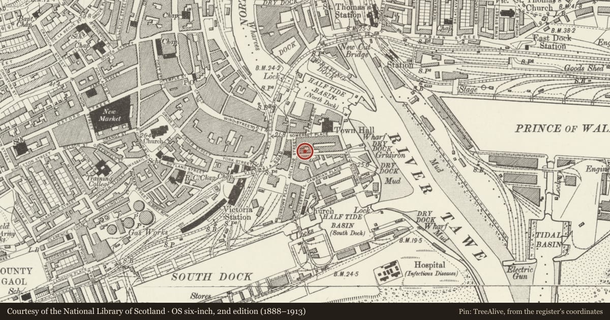
Slide toward Today to fade the historical sheet and see the modern map underneath.
David Rumsey Map Collection, Stanford LibrariesDavid Rumsey Map Collection, Stanford LibrariesDavid Rumsey Map Collection, Stanford LibrariesDavid Rumsey Map Collection, Stanford LibrariesDavid Rumsey Map Collection, Stanford Libraries
5 historical maps cover this location, the earliest the 1636 map "Cornubia : Devonia, Somersetus, Dorcestria, Wiltonia, Glocestria ..." (David Rumsey Map Collection, Stanford Libraries).
Historical maps covering this location
- 1636 · Cornubia : Devonia, Somersetus, Dorcestria, Wiltonia, Glocestria ... (David Rumsey Map Collection, Stanford Libraries)
- 1637 · The fourth table of England. Cornub. Devonia, Somerset etc. (David Rumsey Map Collection, Stanford Libraries)
- 1865 · England and Wales. England No. 6. (David Rumsey Map Collection, Stanford Libraries)
- 1891 · Sheet 10. Ordnance Survey of England and Wales. . (David Rumsey Map Collection, Stanford Libraries)
- 1897 · 247 Swansea (Hills) (David Rumsey Map Collection, Stanford Libraries)
Cadw's description
Location
To rear of main office building of Associated British Ports, Adelaide Street.
History
1902-3. Probably designed by Edwin Seward, architect of Cardiff, for Swansea Harbour Trust. Similar style.
Exterior
2 storey and attic, 3-window domestic building with advanced right hand gable. Red brick, Portland stone, hipped slate roofs with finial and end stack to right. Gable parapets, moulded cornices over 1st floor, band course, keyblocked architraves, small-pane sash windows. Arched ground floor window to right; arched hood on brackets with head corbels to keyblocked doorcase on left, linked side lights, 6-panel door. Yard entry to left with ball-finial gatepiers and double Art Nouveau ironwork gates.
Reason for designation
Group value.
Nearby in the register
- Offices of Associated British Ports Formerly Swansea Harbour TrustCommercialunder 1 mi
- (also known as Prospect Place)Domesticunder 1 mi
- (also known as Prospect Place)Domesticunder 1 mi
- (also known as Prospect Place)Domesticunder 1 mi
Other entries of the same register within about three miles of this one, by straight line.