Cof Cymru: National Historic Assets of Wales · Wales
(also known as Prospect Place)
Waterfront / Y Glannau, Swansea, Wales
A Grade II listed building in Waterfront / Y Glannau, Swansea, designated on 23 April 1952.
The record
- Designation
- Listed building, Grade II
- Broad class
- Domestic
- Date of designation
- 23 April 1952
- Community
- Waterfront / Y Glannau
- Unitary authority
- Swansea
- Country
- Wales
- Coordinates
- 51.61904, -3.93701
- Cadw reference
- 11640
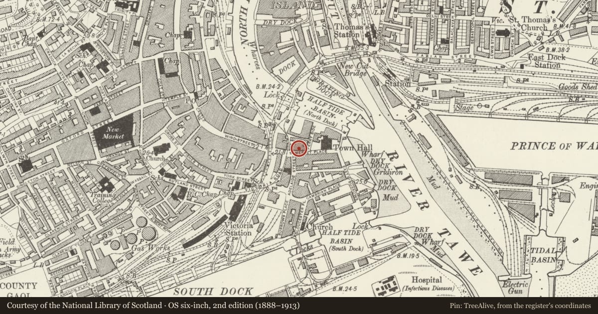
Slide toward Today to fade the historical sheet and see the modern map underneath.
David Rumsey Map Collection, Stanford LibrariesDavid Rumsey Map Collection, Stanford LibrariesDavid Rumsey Map Collection, Stanford LibrariesDavid Rumsey Map Collection, Stanford LibrariesDavid Rumsey Map Collection, Stanford Libraries
5 historical maps cover this location, the earliest the 1636 map "Cornubia : Devonia, Somersetus, Dorcestria, Wiltonia, Glocestria ..." (David Rumsey Map Collection, Stanford Libraries).
Historical maps covering this location
- 1636 · Cornubia : Devonia, Somersetus, Dorcestria, Wiltonia, Glocestria ... (David Rumsey Map Collection, Stanford Libraries)
- 1637 · The fourth table of England. Cornub. Devonia, Somerset etc. (David Rumsey Map Collection, Stanford Libraries)
- 1865 · England and Wales. England No. 6. (David Rumsey Map Collection, Stanford Libraries)
- 1891 · Sheet 10. Ordnance Survey of England and Wales. . (David Rumsey Map Collection, Stanford Libraries)
- 1897 · 247 Swansea (Hills) (David Rumsey Map Collection, Stanford Libraries)
Cadw's description
Location
Section of late Georgian domestic terrace slightly splayed from centre and with exposed gable to Quay Parade (A483).
Exterior
3 storey and basement rendered and painted brick fronts (exposed at No 7), 3 plain pilasters. Continuous slate roof, chimneys to centre only, pitched dormer and boxed eaves to No 7.
3 windows to Nos 2 to 5, 2 windows to Nos 6 and 7; arched recesses to 1st floor centre (wide segmental arch to No 6), continues down as 2 storey recess with brick voussoirs to No 7. Small-paned sash windows (some blind recesses), mostly renewed; modern 1st floor window to No 6 with bracket over. 6-panel Georgian doors up steps; No 6 with overall fascia to pilastered shop front, gabled reveals to 9 panel door on left, shop door to right. 3 storey, 2 window rendered elevation to Ferryside. Gabled extensions to rear of Nos 2 and 3; extension to rear of No 4 runs back to Bath Lane.
Reason for designation
Group value.
Nearby in the register
- (also known as Prospect Place)Domesticunder 1 mi
- (also known as Prospect Place)Domesticunder 1 mi
- (also known as Prospect Place)Domesticunder 1 mi
- (also known as Prospect Place)Domesticunder 1 mi
Other entries of the same register within about three miles of this one, by straight line.