Cof Cymru: National Historic Assets of Wales · Wales
Newton House
Town, Merthyr Tydfil, Wales
A Grade II listed building in Town, Merthyr Tydfil, designated on 13 January 1988.
The record
- Designation
- Listed building, Grade II
- Broad class
- Domestic
- Date of designation
- 13 January 1988
- Community
- Town
- Unitary authority
- Merthyr Tydfil
- Country
- Wales
- Coordinates
- 51.74720, -3.37626
- Cadw reference
- 11474
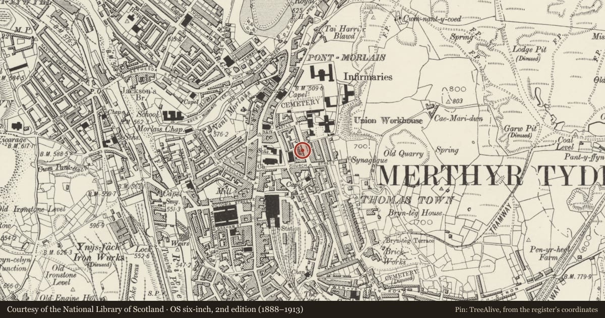
Slide toward Today to fade the historical sheet and see the modern map underneath.
David Rumsey Map Collection, Stanford LibrariesDavid Rumsey Map Collection, Stanford LibrariesDavid Rumsey Map Collection, Stanford LibrariesDavid Rumsey Map Collection, Stanford LibrariesDavid Rumsey Map Collection, Stanford Libraries
5 historical maps cover this location, the earliest the 1636 map "Cornubia : Devonia, Somersetus, Dorcestria, Wiltonia, Glocestria ..." (David Rumsey Map Collection, Stanford Libraries).
Historical maps covering this location
- 1636 · Cornubia : Devonia, Somersetus, Dorcestria, Wiltonia, Glocestria ... (David Rumsey Map Collection, Stanford Libraries)
- 1637 · The fourth table of England. Cornub. Devonia, Somerset etc. (David Rumsey Map Collection, Stanford Libraries)
- 1830 · V.3:11-15:XV. Britisches Reich. A. Kon: England. b. Frstenthum Wales: Shire: 37-40 (David Rumsey Map Collection, Stanford Libraries)
- 1895 · Sheet 11. Ordnance Survey of England and Wales. (David Rumsey Map Collection, Stanford Libraries)
- 1898 · 231 Merthyr Tydfil (Hills) (David Rumsey Map Collection, Stanford Libraries)
Cadw's description
Location
Pair of terraced houses stepped in slope towards Church Street.
Exterior
Mid C19 2-storey, 2-window stucco fronts with neo-classical detailing. Pantile roof to left, slates with ridge cresting to right; rendered and brick stacks. Thick band-courses over ground-floor, doorcases offset to right. Sash windows with glazing bars under slightly cambered heads to No 32, triplet to ground-floor. Plain margins to windows of No 33 without glazing bars. Arched doors in raised surrounds, moulded architraves and keyblocks; 4-panel doors.
Reason for designation
A well-preserved pair in a largely altered terrace.
Nearby in the register
- Newton HouseDomesticunder 1 mi
- Former Miner's Welfare HallHealth and Welfareunder 1 mi
- Statue & Plinth to Sir W.T. LewisCommemorativeunder 1 mi
- 16 New Castle StreetDomesticunder 1 mi
Other entries of the same register within about three miles of this one, by straight line.