Cof Cymru: National Historic Assets of Wales · Wales
Cwm Du Outfall and overflow sluice on Swansea Canal
Ystalyfera, Neath Port Talbot, Wales
A Grade II listed building in Ynysmeudwy, Ystalyfera, Neath Port Talbot, designated on 26 October 1979.
The record
- Designation
- Listed building, Grade II
- Broad class
- Transport
- Date of designation
- 26 October 1979
- Locality
- Ynysmeudwy
- Community
- Ystalyfera
- Unitary authority
- Neath Port Talbot
- Country
- Wales
- Coordinates
- 51.73678, -3.82395
- Cadw reference
- 11202
Slide toward Today to fade the historical sheet and see the modern map underneath.
David Rumsey Map Collection, Stanford LibrariesDavid Rumsey Map Collection, Stanford LibrariesDavid Rumsey Map Collection, Stanford LibrariesDavid Rumsey Map Collection, Stanford LibrariesDavid Rumsey Map Collection, Stanford Libraries
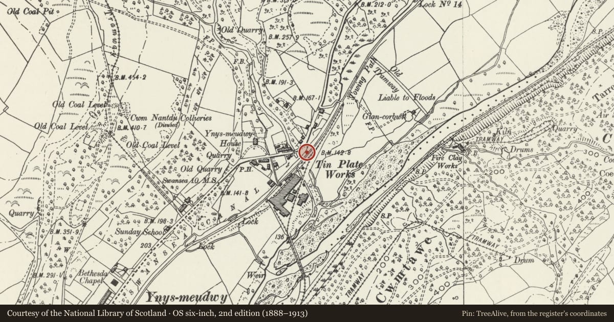
5 historical maps cover this location, the earliest the 1636 map "Cornubia : Devonia, Somersetus, Dorcestria, Wiltonia, Glocestria ..." (David Rumsey Map Collection, Stanford Libraries).
Historical maps covering this location
- 1636 · Cornubia : Devonia, Somersetus, Dorcestria, Wiltonia, Glocestria ... (David Rumsey Map Collection, Stanford Libraries)
- 1637 · The fourth table of England. Cornub. Devonia, Somerset etc. (David Rumsey Map Collection, Stanford Libraries)
- 1891 · Sheet 10. Ordnance Survey of England and Wales. . (David Rumsey Map Collection, Stanford Libraries)
- 1898 · 230 Ammanford (Hills) (David Rumsey Map Collection, Stanford Libraries)
- 1898 · 230 Ammanford (Outline) (David Rumsey Map Collection, Stanford Libraries)
Cadw's description
Location
Situated on the SE side of the Swansea Canal approximately 50m SE of the Cwm Du bridge carrying the A4067 over the canal.
History
Late C18 outfall and overflow sluice on Swansea Canal. Covered and possibly modified in late C20. The 16-mile Swansea Canal was opened in 1798 to Hen Neuadd, Abercraf, declined after the railway opened in 1852 and closed in 1931
Exterior
Said to consist of two chambers, the first described in the 1979 listing, is a stone lined overflow chamber with dividing wall with 4 stop planks and paddle apparatus built on the canal side of it. This chamber is now covered with metal plates surrmounted by a black painted metal control box. The second on the SE side of dividing wall is visible although covered with a metal grid. This is chamber faced with stone with a bow-shaped end wall with small arched outlet.
Reason for designation
Included for its group value with Cwm Du Aqueduct and Ynysmeudwy Uchaf Bridge.
Nearby in the register
- Nant Du Aqueduct on Swansea Canal (partly in Pontardawe community)Transportunder 1 mi
- Nant Du Aqueduct on Swansea Canal (partly in Ystalyfera community)Water Supply and Drainageunder 1 mi
- Ynysmeudwy Uchaf Overbridge on Swansea CanalTransportunder 1 mi
- Waun Coed Colliery magazineIndustrialunder 1 mi
Other entries of the same register within about three miles of this one, by straight line.