Cof Cymru: National Historic Assets of Wales · Wales
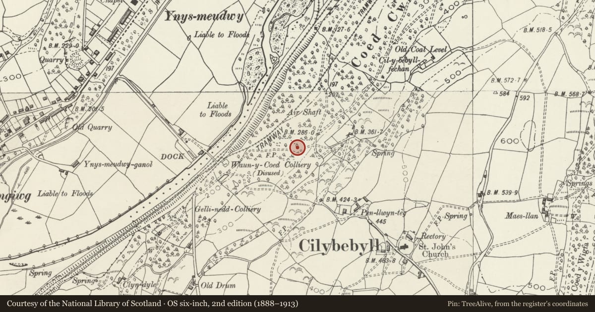
Waun Coed Colliery magazine
Cilybebyll, Neath Port Talbot, Wales
A Grade II listed building in Cilybebyll, Swansea, Neath Port Talbot, designated on 16 December 2003.
The record
- Designation
- Listed building, Grade II
- Broad class
- Industrial
- Date of designation
- 16 December 2003
- Locality
- Cilybebyll
- Town
- Swansea
- Community
- Cilybebyll
- Unitary authority
- Neath Port Talbot
- Country
- Wales
- Coordinates
- 51.72949, -3.82496
- Cadw reference
- 82295
Slide toward Today to fade the historical sheet and see the modern map underneath.
David Rumsey Map Collection, Stanford LibrariesDavid Rumsey Map Collection, Stanford LibrariesDavid Rumsey Map Collection, Stanford LibrariesDavid Rumsey Map Collection, Stanford LibrariesDavid Rumsey Map Collection, Stanford Libraries
5 historical maps cover this location, the earliest the 1636 map "Cornubia : Devonia, Somersetus, Dorcestria, Wiltonia, Glocestria ..." (David Rumsey Map Collection, Stanford Libraries).
Historical maps covering this location
- 1636 · Cornubia : Devonia, Somersetus, Dorcestria, Wiltonia, Glocestria ... (David Rumsey Map Collection, Stanford Libraries)
- 1637 · The fourth table of England. Cornub. Devonia, Somerset etc. (David Rumsey Map Collection, Stanford Libraries)
- 1891 · Sheet 10. Ordnance Survey of England and Wales. . (David Rumsey Map Collection, Stanford Libraries)
- 1898 · 230 Ammanford (Hills) (David Rumsey Map Collection, Stanford Libraries)
- 1898 · 230 Ammanford (Outline) (David Rumsey Map Collection, Stanford Libraries)
Cadw's description
Location
Situated on a wooded hillside some 450m NW of the Church of St John the Evangelist at Cilybebyll.
History
C19 colliery magazine of Waun Coed colliery some 200m SW. It is said that the design of the roof with bricks on edge meant that in event of an explosion the force was directed upwards rather than outwards.
Exterior
Colliery magazine, rectangular plan with main walls of Pennant sandstone rubble with brick infill to each end. Barrel roof originally of five bricks on edge but now mainly two bricks wide and rendered. Door with brick dressings and shallow segmental arch of brick voussoirs on right side of SW end together with small window above.
Reason for designation
Included as a very rare survival of a C19 colliery magazine of special historic importance in this mining area.
Nearby in the register
- Waun y Coed Colliery Branch Canal and Tramroad InclineCanalunder 1 mi
- Ynysmeudwy Uchaf Overbridge on Swansea CanalTransportunder 1 mi
- Nant Du Aqueduct on Swansea Canal (partly in Ystalyfera community)Water Supply and Drainageunder 1 mi
- Nant Du Aqueduct on Swansea Canal (partly in Pontardawe community)Transportunder 1 mi
Other entries of the same register within about three miles of this one, by straight line.