Cof Cymru: National Historic Assets of Wales · Wales
Wynnstay Arms PH
Llangollen, Denbighshire, Wales
A Grade II listed building in Llangollen, Denbighshire, designated on 22 December 1989.
The record
- Designation
- Listed building, Grade II
- Broad class
- Commercial
- Date of designation
- 22 December 1989
- Community
- Llangollen
- Unitary authority
- Denbighshire
- Country
- Wales
- Coordinates
- 52.96987, -3.16904
- Cadw reference
- 1119
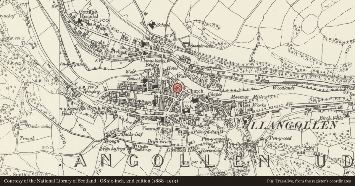
Slide toward Today to fade the historical sheet and see the modern map underneath.
David Rumsey Map Collection, Stanford LibrariesDavid Rumsey Map Collection, Stanford LibrariesDavid Rumsey Map Collection, Stanford LibrariesDavid Rumsey Map Collection, Stanford LibrariesLlyfrgell Genedlaethol Cymru – The National Library of Wales
5 historical maps cover this location, the earliest the 1795 map "To Sir Watkin Williams-Wynn Bart ... the map of the six counties of North Wales is most humbly inscribed by his obedient humble servant" (Llyfrgell Genedlaethol Cymru – The National Library of Wales).
Historical maps covering this location
- 1795 · To Sir Watkin Williams-Wynn Bart ... the map of the six counties of North Wales is most… (Llyfrgell Genedlaethol Cymru – The National Library of Wales)
- 1883 · Watershed map England, Wales 3. (David Rumsey Map Collection, Stanford Libraries)
- 1898 · 121 Wrexham (Hills) (David Rumsey Map Collection, Stanford Libraries)
- 1898 · 121 Wrexham (Outline) (David Rumsey Map Collection, Stanford Libraries)
- 1901 · Sheet 9 and 10. (David Rumsey Map Collection, Stanford Libraries)
Cadw's description
Location
Stepped up from the adjoining properties.
History
Probably earlier C18 structure with applied half-timbering added in 1897.
Exterior
3-storey, 4-window tall and broad, painted roughcast front with plinth and rusticated quoins to left. Black and white detail to 1st and 2nd floors. Slate roof, wave moulded eaves band and unusual fluted frieze; red brick chimney stacks to rear and gable parapets with kneelers. Small pane casement windows alternately 2 and 3-light and with high transoms to ground and 1st floors; moulded surrounds to ground floor. Panelled double doors to 2nd bay with 24 pane overlight and deep fluted brackets; two flights of steps (parallel to the front) up to the entrance. Small pane cellar window and tall carriage entry to far right with boarded doors.
Frieze returns around left gable, a short distance. Rendered rear with very broad cross range; sash glazed bay window and other small pane windows.
Interior
Internally the rear bar has former inglenook fireplace with stone lintel; opening now cut through into dining room. Feather stop chamfer main cross beams.
Reason for designation
Group value.
Nearby in the register
- HenblasCommercialunder 1 mi
- TregarthCommercialunder 1 mi
- Gales Wine BarCommercialunder 1 mi
- 24 Bridge StreetCommercialunder 1 mi
Other entries of the same register within about three miles of this one, by straight line.