Cof Cymru: National Historic Assets of Wales · Wales
Gales Wine Bar
Llangollen, Denbighshire, Wales
A Grade II listed building in Llangollen, Denbighshire, designated on 22 December 1989.
The record
- Designation
- Listed building, Grade II
- Broad class
- Commercial
- Date of designation
- 22 December 1989
- Community
- Llangollen
- Unitary authority
- Denbighshire
- Country
- Wales
- Coordinates
- 52.96995, -3.16924
- Cadw reference
- 1118
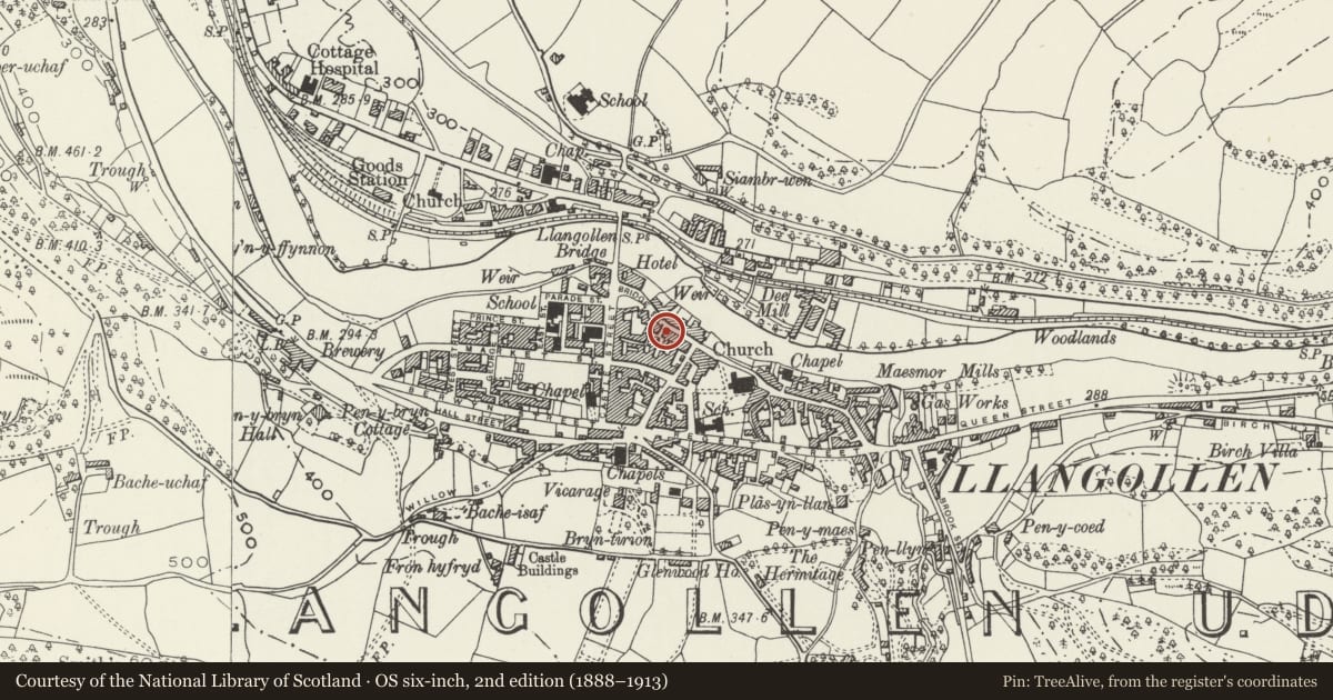
Slide toward Today to fade the historical sheet and see the modern map underneath.
David Rumsey Map Collection, Stanford LibrariesDavid Rumsey Map Collection, Stanford LibrariesDavid Rumsey Map Collection, Stanford LibrariesDavid Rumsey Map Collection, Stanford LibrariesLlyfrgell Genedlaethol Cymru – The National Library of Wales
5 historical maps cover this location, the earliest the 1795 map "To Sir Watkin Williams-Wynn Bart ... the map of the six counties of North Wales is most humbly inscribed by his obedient humble servant" (Llyfrgell Genedlaethol Cymru – The National Library of Wales).
Historical maps covering this location
- 1795 · To Sir Watkin Williams-Wynn Bart ... the map of the six counties of North Wales is most… (Llyfrgell Genedlaethol Cymru – The National Library of Wales)
- 1883 · Watershed map England, Wales 3. (David Rumsey Map Collection, Stanford Libraries)
- 1898 · 121 Wrexham (Hills) (David Rumsey Map Collection, Stanford Libraries)
- 1898 · 121 Wrexham (Outline) (David Rumsey Map Collection, Stanford Libraries)
- 1901 · Sheet 9 and 10. (David Rumsey Map Collection, Stanford Libraries)
Cadw's description
Location
Detached to right, midway along the street.
History
Dated 1775 and initialled RDM.
Exterior
Georgian 3 storey 3-window whitewashed brick front with painted stone quoins and plinth - M shaped slate roof, red brick end chimney stacks and kneelers to gable parapets; boxed eaves. Almost flush frame sash windows with marginal glazing bars. Narrower to centre and with cambered heads to 1st floor. Overall ground floor fascia with dentilled cornice and end pilasters; shop window to left with splayed entrance and half glazed doors, 4-panel door up steps to right and further sash windows beyond with blind cover. Projecting chimney breasts to the right end. Modern extension to rear. Fine Art Nouveau doorplate to rear door (also to inner side).
Interior
The ground floor is largely wainscoatted with panelling brought from Norfolk, both to the bar/restaurant and the breakfast room. Toads back handrail to main stairs with turned balusters. Panelled and boarded doors.
Reason for designation
Group value.
Nearby in the register
- 16 Bridge StreetCommercialunder 1 mi
- Wynnstay Arms PHCommercialunder 1 mi
- 14 Bridge StreetCommercialunder 1 mi
- Village PineCommercialunder 1 mi
Other entries of the same register within about three miles of this one, by straight line.