Cof Cymru: National Historic Assets of Wales · Wales
Dovecote at Edwinsford
Llansawel, Carmarthenshire, Wales
A Grade II listed building in Edwinsford, Llansawel, Carmarthenshire, designated on 18 August 1993.
The record
- Designation
- Listed building, Grade II
- Broad class
- Domestic
- Date of designation
- 18 August 1993
- Locality
- Edwinsford
- Community
- Llansawel
- Unitary authority
- Carmarthenshire
- Country
- Wales
- Coordinates
- 51.99452, -3.99710
- Cadw reference
- 11184
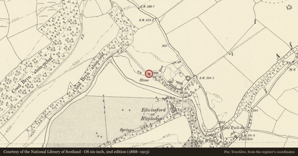
Slide toward Today to fade the historical sheet and see the modern map underneath.
David Rumsey Map Collection, Stanford LibrariesDavid Rumsey Map Collection, Stanford LibrariesDavid Rumsey Map Collection, Stanford LibrariesDavid Rumsey Map Collection, Stanford LibrariesDavid Rumsey Map Collection, Stanford Libraries
5 historical maps cover this location, the earliest the 1860 map "41. Caermathen." (David Rumsey Map Collection, Stanford Libraries).
Historical maps covering this location
- 1860 · 41. Caermathen. (David Rumsey Map Collection, Stanford Libraries)
- 1891 · Sheet 10. Ordnance Survey of England and Wales. . (David Rumsey Map Collection, Stanford Libraries)
- 1898 · 212 Llandovery (Hills) (David Rumsey Map Collection, Stanford Libraries)
- 1898 · 212 Llandovery (Outline) (David Rumsey Map Collection, Stanford Libraries)
- 1901 · Sheet 14. (David Rumsey Map Collection, Stanford Libraries)
Cadw's description
Location
Edwinsford is reached off the B4337 between Llansawel and Talley and is situated on the banks of the River Cothi which is the boundary between the two communities. The dovecote is on the opposite (N) side of the river to the mansion to the W of Ty Pe
History
Early/mid C18 estate building, formerly belonging to the Edwinsford estate. The derelict mansion was the ancient seat of the Williams family.
Exterior
Early/mid C18. Rubble built square-plan dovecote with pyramidal stone tiled roof and square plan timber cupola with round arched dove-holes, itself also having stone tiled roof as above. Wide soffits. Continuous stone perch-ledge below wall-plate. Boarded door to E; timber lintel.
Reason for designation
Group value with mansion and listed estate buildings
Nearby in the register
- Ty PeggiDomesticunder 1 mi
- Walled Garden at EdwinsfordDomesticunder 1 mi
- SundialGardens, Parks and Urban Spacesunder 1 mi
- Edwinsford Home FarmAgriculture and Subsistenceunder 1 mi
Other entries of the same register within about three miles of this one, by straight line.