Cof Cymru: National Historic Assets of Wales · Wales
Angel Hotel
Llandeilo, Carmarthenshire, Wales
A Grade II listed building in Llandeilo, Carmarthenshire, designated on 24 June 1991.
The record
- Designation
- Listed building, Grade II
- Broad class
- Commercial
- Date of designation
- 24 June 1991
- Community
- Llandeilo
- Unitary authority
- Carmarthenshire
- Country
- Wales
- Coordinates
- 51.88334, -3.99263
- Cadw reference
- 11088
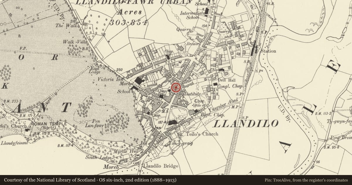
Slide toward Today to fade the historical sheet and see the modern map underneath.
David Rumsey Map Collection, Stanford LibrariesDavid Rumsey Map Collection, Stanford LibrariesDavid Rumsey Map Collection, Stanford LibrariesDavid Rumsey Map Collection, Stanford LibrariesDavid Rumsey Map Collection, Stanford Libraries
5 historical maps cover this location, the earliest the 1860 map "41. Caermathen." (David Rumsey Map Collection, Stanford Libraries).
Historical maps covering this location
- 1860 · 41. Caermathen. (David Rumsey Map Collection, Stanford Libraries)
- 1891 · Sheet 10. Ordnance Survey of England and Wales. . (David Rumsey Map Collection, Stanford Libraries)
- 1898 · 212 Llandovery (Outline) (David Rumsey Map Collection, Stanford Libraries)
- 1898 · 212 Llandovery (Hills) (David Rumsey Map Collection, Stanford Libraries)
- 1901 · Sheet 14. (David Rumsey Map Collection, Stanford Libraries)
Cadw's description
Location
On the street line opposite the Castle Hotel.
Exterior
Late Cl9 remodelling of earlier Cl9 building. 2+ storey, 3 window. Colourwashed roughcast on rubble. Moderately pitched slate roof, oversailing eaves, close verges. Rendered stacks.
Gablets over 2nd floor windows. Deep verges, ornamental bargeboards with clover-leaf motif. Pierced ridge tiles. Moulded round arched hoods to round topped Victorian sash windows. Canted oriel to centre at lst floor, hipped slate roof, Cambered tops to Victorian sash and narrow side sashes. Similar sashes to flanking windows with cambered moulded architraves, continuous sill band.
Victorian sashes to ground floor, included architraves. Central doorway with doorcase. Corniced hood on brackets over sunk panelled pilasters. Large rectangular fanlight over 4 moulded panel door. Doorway to tunnel passage at extreme right.
Reason for designation
Group value.
Nearby in the register
- SniftersCommercialunder 1 mi
- 66 Rhosmaen StreetCommercialunder 1 mi
- Dewi Price & Co SolicitorsCommercialunder 1 mi
- NO.115 Including tunnel passage & rear range to rightCommercialunder 1 mi
Other entries of the same register within about three miles of this one, by straight line.