Cof Cymru: National Historic Assets of Wales · Wales
Arnon Cottage
Llangollen, Denbighshire, Wales
A Grade II listed building in Llangollen, Denbighshire, designated on 22 December 1989.
The record
- Designation
- Listed building, Grade II
- Broad class
- Domestic
- Date of designation
- 22 December 1989
- Community
- Llangollen
- Unitary authority
- Denbighshire
- Country
- Wales
- Coordinates
- 52.97282, -3.17691
- Cadw reference
- 1092
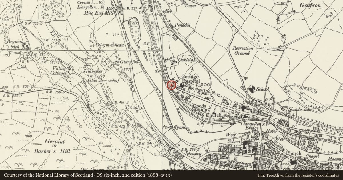
Slide toward Today to fade the historical sheet and see the modern map underneath.
David Rumsey Map Collection, Stanford LibrariesDavid Rumsey Map Collection, Stanford LibrariesDavid Rumsey Map Collection, Stanford LibrariesDavid Rumsey Map Collection, Stanford LibrariesLlyfrgell Genedlaethol Cymru – The National Library of Wales
5 historical maps cover this location, the earliest the 1795 map "To Sir Watkin Williams-Wynn Bart ... the map of the six counties of North Wales is most humbly inscribed by his obedient humble servant" (Llyfrgell Genedlaethol Cymru – The National Library of Wales).
Historical maps covering this location
- 1795 · To Sir Watkin Williams-Wynn Bart ... the map of the six counties of North Wales is most… (Llyfrgell Genedlaethol Cymru – The National Library of Wales)
- 1883 · Watershed map England, Wales 3. (David Rumsey Map Collection, Stanford Libraries)
- 1898 · 121 Wrexham (Hills) (David Rumsey Map Collection, Stanford Libraries)
- 1898 · 121 Wrexham (Outline) (David Rumsey Map Collection, Stanford Libraries)
- 1901 · Sheet 9 and 10. (David Rumsey Map Collection, Stanford Libraries)
Cadw's description
Location
At right angles to the bend in the road; on the edge of the town. Railway below to the left.
History
Earlier C19, later alterations.
Exterior
2-storey, late Georgian 4-bay pebbledash front, the 1st and 3rd bays of which are full height splayed bays with pyramidal roofs. Slate roof, boarded eaves and pebbledash chimney stacks (to ends and right of centre). Small pane sash windows including to the sides of the splayed bays. Small gable above window over entrance; flat hood carried on columns and 4-paned double door with overlight. Small pane French windows to right.
Pebbledash right gable end, splayed out to base. Small pane sashes to 1 + 3-window rear, camber headed to ground floor; gabled porch.
Nearby in the register
- Fair View (including outbuilding Range to right)Domesticunder 1 mi
- Good Shed at the Llangollen Railway Station Goods YardTransportunder 1 mi
- Railway Overbridge ,including ramped paths & revetments to W. of Llangollen StationTransportunder 1 mi
- Canal Bridge (no.46 at Penddol)Transportunder 1 mi
Other entries of the same register within about three miles of this one, by straight line.