Cof Cymru: National Historic Assets of Wales · Wales
St James' Church
Llwydcoed, Rhondda Cynon Taff, Wales
A Grade II listed building in Llwydcoed, Rhondda Cynon Taff, designated on 10 January 1991.
The record
- Designation
- Listed building, Grade II
- Broad class
- Religious, Ritual and Funerary
- Date of designation
- 10 January 1991
- Locality
- Llwydcoed
- Community
- Llwydcoed
- Unitary authority
- Rhondda Cynon Taff
- Country
- Wales
- Coordinates
- 51.73335, -3.46300
- Cadw reference
- 10895
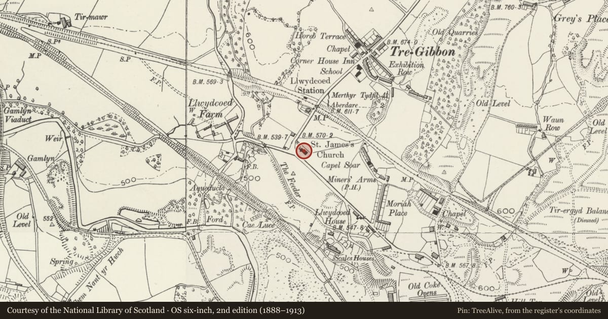
Slide toward Today to fade the historical sheet and see the modern map underneath.
David Rumsey Map Collection, Stanford LibrariesDavid Rumsey Map Collection, Stanford LibrariesDavid Rumsey Map Collection, Stanford LibrariesDavid Rumsey Map Collection, Stanford LibrariesDavid Rumsey Map Collection, Stanford Libraries
5 historical maps cover this location, the earliest the 1608 map "(13) Cambriae Typus." (David Rumsey Map Collection, Stanford Libraries).
Historical maps covering this location
- 1608 · (13) Cambriae Typus. (David Rumsey Map Collection, Stanford Libraries)
- 1636 · Cornubia : Devonia, Somersetus, Dorcestria, Wiltonia, Glocestria ... (David Rumsey Map Collection, Stanford Libraries)
- 1637 · The fourth table of England. Cornub. Devonia, Somerset etc. (David Rumsey Map Collection, Stanford Libraries)
- 1830 · V.3:11-15:XV. Britisches Reich. A. Kon: England. b. Frstenthum Wales: Shire: 37-40 (David Rumsey Map Collection, Stanford Libraries)
- 1898 · 231 Merthyr Tydfil (Hills) (David Rumsey Map Collection, Stanford Libraries)
Cadw's description
Location
Set in a slight slope on the corner with Merthyr Road at the NW end of the village. Opposite the junction with Cwmynysmintan Road.
History
Built in l895 by G E Halliday, diocesan architect.
Exterior
Early Gothic with simple Arts and Crafts influence; red brick with purple tiled roofs. Aisless 4-bay nave with W bellcote and S porch and lower 2-bay chancel with N vestry. Rendered W end and plinth; stepped buttresses to the eastern bay of the nave. Lancet windows with voussoirs and labels; diamond leaded glazing; 3-light E window with stepped up central lancet. Stepped pyramidal bellcote with timber openwork bellstage the roof of which has swept eaves and crucifix finial. 4 cusped arches to each side. Half timbered porch on brick base; pendant and finial broken, S-shaped braces to the sides. Pointed arch entrance with boarded doors.
Interior
Rendered interior with red brick dressings. Arched braced collar trusses springing from low set stone corbels; boarded roof. 2-order chancel arch; low arch to vestry on N side of chancel now infilled. Sanctuary is part wainscoated with Gothic panelling. Decorated Gothic pulpit, octagonal font and low iron chancel screen with gates.
Nearby in the register
- Merthyr Road Railway BridgeNo class recordedunder 1 mi
- War MemorialCommemorativeunder 1 mi
- Llwydcoed Tramroad BridgeTransportunder 1 mi
- Gelli-Isaf Tramroad Bridge, Abernant TramroadBridgeunder 1 mi
Other entries of the same register within about three miles of this one, by straight line.