Cof Cymru: National Historic Assets of Wales · Wales
Vicarage to St Fagan's Church
Aberdare West, Rhondda Cynon Taff, Wales
A Grade II listed building in Trecynon, Aberdare West, Rhondda Cynon Taff, designated on 10 January 1991.
The record
- Designation
- Listed building, Grade II
- Broad class
- Domestic
- Date of designation
- 10 January 1991
- Locality
- Trecynon
- Community
- Aberdare West
- Unitary authority
- Rhondda Cynon Taff
- Country
- Wales
- Coordinates
- 51.72386, -3.45923
- Cadw reference
- 10893
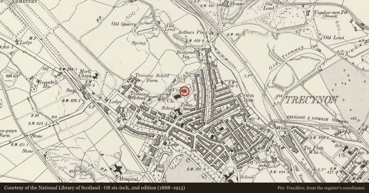
Slide toward Today to fade the historical sheet and see the modern map underneath.
David Rumsey Map Collection, Stanford LibrariesDavid Rumsey Map Collection, Stanford LibrariesDavid Rumsey Map Collection, Stanford LibrariesDavid Rumsey Map Collection, Stanford LibrariesDavid Rumsey Map Collection, Stanford Libraries
5 historical maps cover this location, the earliest the 1636 map "Cornubia : Devonia, Somersetus, Dorcestria, Wiltonia, Glocestria ..." (David Rumsey Map Collection, Stanford Libraries).
Historical maps covering this location
- 1636 · Cornubia : Devonia, Somersetus, Dorcestria, Wiltonia, Glocestria ... (David Rumsey Map Collection, Stanford Libraries)
- 1637 · The fourth table of England. Cornub. Devonia, Somerset etc. (David Rumsey Map Collection, Stanford Libraries)
- 1830 · V.3:11-15:XV. Britisches Reich. A. Kon: England. b. Frstenthum Wales: Shire: 37-40 (David Rumsey Map Collection, Stanford Libraries)
- 1865 · England and Wales. England No. 6. (David Rumsey Map Collection, Stanford Libraries)
- 1898 · 231 Merthyr Tydfil (Hills) (David Rumsey Map Collection, Stanford Libraries)
Cadw's description
Location
Immediately to NE of the Church, slightly stepped down. Reached up a lane from the street; also direct from the churchyard.
History
Built l876-7 by T Talbot Bury, architect of London who also built the Church in l851-3.
Exterior
l+ storeys cement rendered structure with slate roofs (partly hipped). 2 diagonally set chimney stacks and other modern stacks. The main entrance is to S side with Gothic gabled porch distinctive for its quatrefoil panelled sides and cusped arch to front. Gable to left with l6 pane sash over later shallow bay projection. The E side has 2 gables the left hand of which is stepped forward and has Plymouth family coat of arms, some l6-pane sash glazing, splayed bay to left and twinned 8-pane sashes to right. Both gables have pendant and finials. Gable to N side again with small pane sashes and rear porch. Central gabled dormer to rear and lateral chimney breast with stack removed.
Ironwork finial in the garden was formerly on church W end before building of tower.
Interior
Internally, the public rooms lead off a long hall panelled doors and reveals; also panelled shutters throughout ground floor. High ceilings with cornices except to front left study which has false ceiling. Simple uprights to dog leg staircase with quatrefoil punched string.
Reason for designation
Included for group value with St Fagans Church.
Nearby in the register
- St. Fagan's ChurchReligious, Ritual and Funeraryunder 1 mi
- Carmel (Bryn Sion) ChapelReligious, Ritual and Funeraryunder 1 mi
- Hall attached to Capel Y BedyddwyrReligious, Ritual and Funeraryunder 1 mi
- Gates 7 Gate Piers, including Flanking Railings, at NW Entrance to Aberdare ParkDomesticunder 1 mi
Other entries of the same register within about three miles of this one, by straight line.