Cof Cymru: National Historic Assets of Wales · Wales
Hall attached to Capel Y Bedyddwyr
Aberdare West, Rhondda Cynon Taff, Wales
A Grade II listed building in Trecynon, Aberdare West, Rhondda Cynon Taff, designated on 10 January 1991.
The record
- Designation
- Listed building, Grade II
- Broad class
- Religious, Ritual and Funerary
- Date of designation
- 10 January 1991
- Locality
- Trecynon
- Community
- Aberdare West
- Unitary authority
- Rhondda Cynon Taff
- Country
- Wales
- Coordinates
- 51.72224, -3.45678
- Cadw reference
- 10879
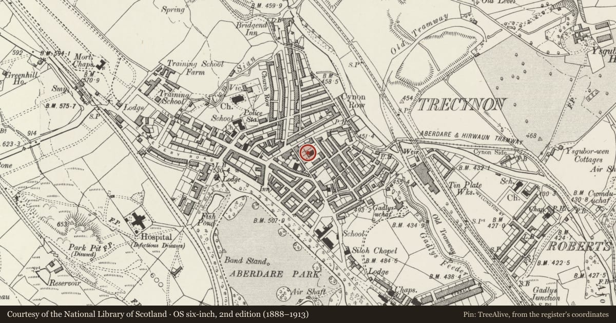
Slide toward Today to fade the historical sheet and see the modern map underneath.
David Rumsey Map Collection, Stanford LibrariesDavid Rumsey Map Collection, Stanford LibrariesDavid Rumsey Map Collection, Stanford LibrariesDavid Rumsey Map Collection, Stanford LibrariesDavid Rumsey Map Collection, Stanford Libraries
5 historical maps cover this location, the earliest the 1636 map "Cornubia : Devonia, Somersetus, Dorcestria, Wiltonia, Glocestria ..." (David Rumsey Map Collection, Stanford Libraries).
Historical maps covering this location
- 1636 · Cornubia : Devonia, Somersetus, Dorcestria, Wiltonia, Glocestria ... (David Rumsey Map Collection, Stanford Libraries)
- 1637 · The fourth table of England. Cornub. Devonia, Somerset etc. (David Rumsey Map Collection, Stanford Libraries)
- 1830 · V.3:11-15:XV. Britisches Reich. A. Kon: England. b. Frstenthum Wales: Shire: 37-40 (David Rumsey Map Collection, Stanford Libraries)
- 1865 · England and Wales. England No. 6. (David Rumsey Map Collection, Stanford Libraries)
- 1898 · 231 Merthyr Tydfil (Hills) (David Rumsey Map Collection, Stanford Libraries)
Cadw's description
Location
Built in l852 to the design of Thomas Joseph, local coal owner and engineer; cost ú920. Became a self-governing church in l855 and then in l893 was extensively remodelled. In l904 further alterations were made and new classrooms were added.
Exterior
Coursed rubble 3-bay gable front with different masonry to gallery floor relating to the remodelling. Slate roof. Pediment treatment and freestone dressings including entablature and cornice; eroded datestone to pediment. Pilasters flank the semi-circular headed 8-pane gallery windows with voussoirs and deep sill panels - the central one inserted Heol-y-Felin. The ground floor is fractionally set forward. Central semi-circular arched doorway with roll moulded jambs and panelled double doors; rounded steps. 4-pane windows to either side. The 'facade' is continued around the corners. The left side of the chapel has 4 tall round arched headed windows with impost band; further windows stepped up beyond including a horned sash, lighting the hall/vestry. Side door here opens onto a transverse passage with chapel to right and hall/vestry etc to left. This extension projects to the right of the chapel and has gable end facing the street with porch and 2 round arched headed windows. Cement render rear with louvered opening.
Interior
Rectangular galleried interior with scribed rendered walls. Boarded and ribbed ceiling including plaster roses and ventilation panels; coved cornice. Raked gallery, are on tapered cylindrical iron columns painted in imitation of 'scagliola' work; manufactured by Dare Fychan Foundry, DáRáLewis l852. Bracketed panelled front with inset lincrusta ornament and Gothic arched panels, 'set fawr' and 'set canu' are placed well forward marking the extent of the first chapel; the organ behind relates to the remodelling as does the tulip pattern iron balustrade, with Art Nouveau influences.
Specially good monument to Owen Harris (former Minister of the Chapel - died l905); stone relief bust with seated women to either side. 4-bay hall with arched collar trusses.
Reason for designation
Group value with Ebenezer Chapel.
Nearby in the register
- Heol Y Felin (Capel Y Bedyddwyr)Religious, Ritual and Funeraryunder 1 mi
- Capel EbenezerReligious, Ritual and Funeraryunder 1 mi
- Carmel (Bryn Sion) ChapelReligious, Ritual and Funeraryunder 1 mi
- Hen Dy Cwrdd ChapelReligious, Ritual and Funeraryunder 1 mi
Other entries of the same register within about three miles of this one, by straight line.